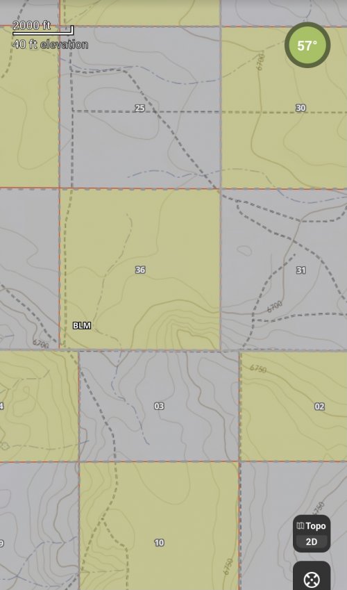
Corner hoppers claim they can step from one public parcel over a small point but is this feasible or possible.
From the Garmin website on GPS accuracy. Garmin® GPS receivers are accurate to within 15 meters (49 feet) 95% of the time. Generally, users will see accuracy within 5 to 10 meters (16 to 33 feet) under normal conditions. If you can’t find a corner pin where is the actual corner you stepped over and even if you did is that the actual de facto corner?
We also know because of the Earth’s curvature some of the square mile sections of land don’t actually touch at the corner. Some sections have gaps of hundreds of feet and don’t actually touch at the corners as 2 dimensional maps show. Many of the 19th century surveys with corner markets from the 1860s PLSS Railroad plats were done with Gross surveying errors and even fraudulent land grab surveys. Most of the survey corner pins I have actually found were done with surveys completed in the 1950s and 1960s so well before GPS days and could be off by hundreds of feet if not acres of land.
Many use software from mapping companies which rely on US Topo maps. US Topo maps are not legal documents and the PLSS (Public land Survey System representation on them is not considered legally authoritative according to the USGS.
View attachment 189283