Ask your onX Hunt questions here!

So I currently have 3 chips from back when it was first starting up. Rockies North, Rockies South and Nevada.

If I buy the "Elite" membership it says that I can update my chips. Will it update the Rockies North and Rockies South chips? Those were cheaper at the time because they didn't include landowner names.

Just checking to see if that is the case before I decide whether to buy the Elite 50 state membership or the single state for the one new state I'm hunting this year.

What happens when my year expires, the updated information on my chips doesn't get locked or anything does it?

Thanks, Nathan
 
Is there a way to directly enter a waypoint via coordinates? The only way I’ve found to do so is use the search icon, enter coordinates, and then save it as a waypoint. Is there a more direct way of doing so?
 
Is there a way to directly enter a waypoint via coordinates? The only way I’ve found to do so is use the search icon, enter coordinates, and then save it as a waypoint. Is there a more direct way of doing so?
Negative. You could always have a waypoint shared to you, or you could enter it on the website and have it autopopulate to your phone.
 
Negative. You could always have a waypoint shared to you, or you could enter it on the website and have it autopopulate to your phone.

That really sucks, and I was really unhappy as I was struggling to enter waypoints the other day.
 
So I currently have 3 chips from back when it was first starting up. Rockies North, Rockies South and Nevada.

If I buy the "Elite" membership it says that I can update my chips. Will it update the Rockies North and Rockies South chips? Those were cheaper at the time because they didn't include landowner names.

Just checking to see if that is the case before I decide whether to buy the Elite 50 state membership or the single state for the one new state I'm hunting this year.

What happens when my year expires, the updated information on my chips doesn't get locked or anything does it?

Thanks, Nathan

The Regional Chips are no longer available so what we typically do is replace them with the state chips and the Elite membership.
Give us a call at 406-540-1600 and we can get that all sorted out.
 
Is there a way to directly enter a waypoint via coordinates? The only way I’ve found to do so is use the search icon, enter coordinates, and then save it as a waypoint. Is there a more direct way of doing so?

As you mentioned, at this time the only way to do it would be to do a search, then go down to Map Tools and select Add Waypoint. We appreciate the feedback so I'll pass that along to our team to see if it is something we can implement into the app!
 
The Regional Chips are no longer available so what we typically do is replace them with the state chips and the Elite membership.
Give us a call at 406-540-1600 and we can get that all sorted out.

Thanks for the info. I went ahead and called and got lined out on swapping out the regional chips and signed up for 1 year of the Elite membership.

Pretty easy transaction so far. Looking forward to checking out some of the new features since I bought my chips.

Thanks, Nathan
 
Maybe it is just me but it seems the transparency setting has disappeared from all of my layers on the web app but they are available on the ios app....
 
I have been having problems with the app on my phone. When I turn on airplane mode and then turn on the app, none of the blm yellow, forest green, etc shows up. However, if I turn on the app first with signal and then go to airplane it is all there. This is not a convenient work around as there will not always be signal to start this way. Am i doing something wrong? Yes, all of the maps that I downloaded had the govt lands layers on when I saved them. Any help?
 
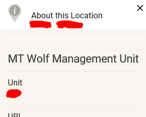
I changed this at one time to review wolf management areas though do not recall how I went about this. I imagine anyone would be able to answer this and would appreciate. Where is the selection tab to change the intended game to hunt?

From my laptop screen:
onxscreenpic.PNG

Thanks.
 
I changed this at one time to review wolf management areas though do not recall how I went about this. I imagine anyone would be able to answer this and would appreciate. Where is the selection tab to change the intended game to hunt?

From my laptop screen:
View attachment 113531

Thanks.
Go to your Montana layers, then hunting districts, then at the bottom of that block you’ll see layer settings. Click on that and then you can change between species.
 
Is there a way to increase the resolution inside a downloaded map. I downloaded the highest resolution option but when I use the map online, there is still greater resolution that I find when I go offline. This is primarily noticed in the zoom detail.
 
OnX has been a huge impact to my hunting since I started using it three years ago. It would make my life even easier if it had a 3D abilities like google earth. I apologize if this has been asked. I looked through a few pages and didn't see anything. Is 3d mapping in the future, If so is there a estimated release date of that ability?
 
Is there a way to increase the resolution inside a downloaded map. I downloaded the highest resolution option but when I use the map online, there is still greater resolution that I find when I go offline. This is primarily noticed in the zoom detail.
Nope it is what it is. To get more resolution you need to download more data which uses up more space on the device. I imagine they have tried to hit a sweet spot between res and data size. I haven't tried this but there might be offline capabilies in google earth, then you could import your onx waypoints into it and maybe get what you are looking for.
 
Feature Request: Better Filtering/Categorization of My Content. I would love to be able to at least filter by name so I can group items for the unit or area I am focusing on versus endless scrolling and searching. I want to hunt for animals not way-points....
 
After this morning, I think it would be a great idea if onx chips were blaze orange. There is a 0% chance of finding those things in tall grass after they pop out while replacing batteries.
 
Request OR maybe it's present and I've not learned how to access... attach photos to waypoints? Garmin has this on their gps unit... It would be great to do such from a phone app as my pics are from my phone anyhow...
 
You can share waypoints and tracks; edit the feature and select “share”.

Best resolution is to download 5 mile maps.

I agree, onX needs folders for categorizing data.
 
Back
Top