WapitiBob
Well-known member
Worthless without a track.


Follow along with the video below to see how to install our site as a web app on your home screen.
Note: This feature may not be available in some browsers.

Just figured lawyers would twist it all around. Still, I don't know how it matters in a lawsuit over devaluation.Who cares if he was hunting while he marked a waypoint? I’d mark where I saw elk, regardless of who’s property they were standing on.

Even if they marked the waypoint exactly where they were standing on elk mtn that doesn’t seem to have any bearing on corner crossing as far as I’m concerned.
Good question, but even if it did differentiate I would still argue the overall accuracy of on-x and GPS mapping systems in general.does the onX metadata differentiate between a “mark my location” way point and a random way point your throw on the map?
I suspect these aren’t even “mark my location” way points and it’s a nothing burger that Fred is all worked up over

This seems like a desperation move or scare tactic by the landowner and his lawyers.

This, I mark whatever I see no matter where it is relative to me.Who cares if he was hunting while he marked a waypoint? I’d mark where I saw elk, regardless of who’s property they were standing on.
Requested vs. Subpoenaed would be the difference. I can request information and be denied. But an attorney, whether representing the state or the individual, can subpoena records. I would assume that OnX received a court ordered subpoena to provide any and all OnX data pertaining to the 4 hunters in and around Elk Mountain.I do have some question.
1. What’s the requirement for a company to provide the information requested by a lawyer for the making of their case? It would seem that if their is no requirement unless it’s court ordered @onX Hunt sided with the landowner in this case.
2. Nothing in their TOU talk about providing your data including waypoints to a 3rd party. It states that users content is the user sole responsibility. Whose data is it when it’s your data that’s stored on their servers?
I'm really curious if it's the lawyers grasping at straws or if Eschelman himself is pushing these absurd arguments and the lawyers are like, "Whatever you say, boss."Response from hunters:
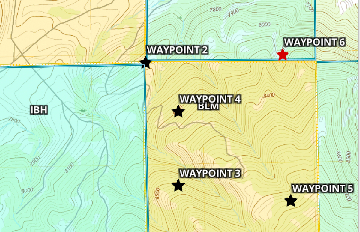
Corner crossers reject GPS ‘Waypoint 6’ as trespass proof - WyoFile
Mapping app allows users to set digital markers without standing on private land, Missouri hunters assert in fight against ranch owner’s $7M civil suit.wyofile.com
Either way he's just wasting money on those lawyers at this point.I'm really curious if it's the lawyers grasping at straws or if Eschelman himself is pushing these absurd arguments and the lawyers are like, "Whatever you say, boss."
I'm really curious if it's the lawyers grasping at straws or if Eschelman himself is pushing these absurd arguments and the lawyers are like, "why not we are changing him by the hour."