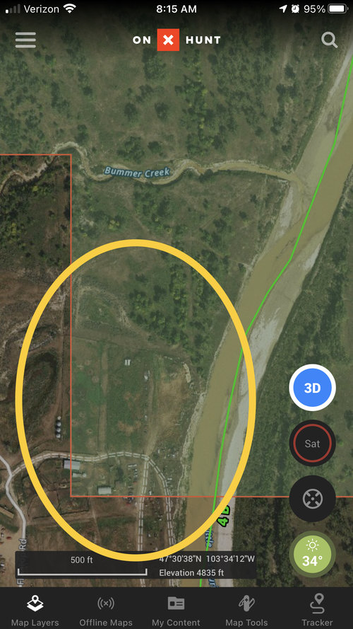
How does stuff like this happen? I have checked the owner data (USFS) from another source and it appears to be correct. The section lines on the ground are spot on and correspond with the map in the area. North Dakota 4C.
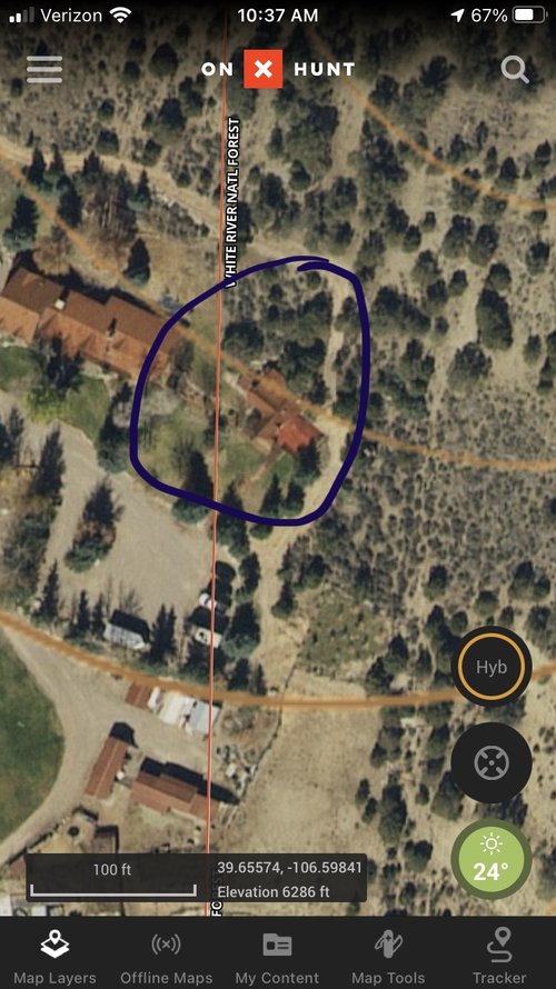
I can only guess since I didn’t want to drive into the yard and check it out. In the past when I have hunted the area these folks were more than happy to post public with No Hunting signs. It seems the prevalence of OnX has put an end to that though. So can you get a permit for an auto salvage yard then too?
Lots of places like cabins and homes on 99 year leases on FS lands. Sometimes they come up for sale with the lease approval caveat.
Lots of places slowly start to encroach onto landlocked public...I know of several ranches that have piles of stuff stacked on landlocked BLM and FS lands. This looks to be a case of encroachment of their junk on leased use. It very may be a case where no lease exists (similar to a Bundy situation)
Judging from the location and it's association with the river I'd guess the local DEQ knows of this place but an anonymous letter with photos may fix the issue.
If you spend much time looking at public land near developed areas you'll find lots and lots of this, some of it's authorized, some isn't, and may be in various stages of process (trespass, retro-authorization, etc.) or unknown to the agency. The easiest way to find out is to call and ask the local realty specialist for the managing agency.
How does stuff like this happen? I have checked the owner data (USFS) from another source and it appears to be correct. The section lines on the ground are spot on and correspond with the map in the area. North Dakota 4C.
This is almost certainly systematic error on the part of the mapping system vs a landowner building where they weren't supposed to. OnX, I believe, uses County GIS/Tax maps which are often times not accurate themselves, and likely vary in accuracy from County to County. Looking at my own property via my County GIS maps shows almost 100 ft of error, and it is consistent (so systematic not random error) across the other properties all around me. Obviously we all didn't put our fences 100 ft on the wrong side of all of our properties.
Exactly. The GIS maps are good for getting a general overlay and showing property ownership info but a survey is the only way to definitively determine property boundaries.