Hunting GPS Maps promo

seidelm,

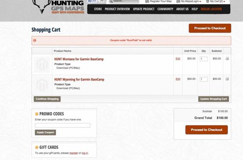
Any particular reason the huntinggpsmaps.com site says the coupon code "HuntTalk" is not valid? Tried putting WY/MT downloads in the cart but it wouldn't recognize the code.

Hmmm. I just tried it and it worked. No quotation marks, no space, capital "H" and capital "T". Just like you see it below.

HuntTalk

Hope it works when you try it again. Thanks to Matt for being so helpful in answering questions and to Hunting GPS Maps for doing this special offer for our members.
 
Trying to take a snapshot, let's see if it worked.
 

Attachments

  • Screen shot 2013-06-22 at 10.17.40 PM.jpg
    Screen shot 2013-06-22 at 10.17.40 PM.jpg
    45.7 KB · Views: 3,588
Looks like you are trying to buy the Basecamp version, not the map chip or chip download, thus the promo code will not work. See the screen shot below of how it works when buying the chip or the download for those two states.

Hope that helps. Thanks for putting up with the frustration.

GPS.jpg
 
Gbfan,

The Basecamp version is just for your computer only it does not come with any unlock codes. If you want it for your GPS and Computer do the GPS Maps vesion then choose download or SD card. If you just want the BaseCamp version let me know and I will get you a good deal on Monday when I can run orders.

Cheers,
Matt
 
Been wanting to get the Idaho, geuss now is the time. But I see the Hunt Rockies has ID,MT, and WY. I see it doesn't have land owner names but what else is missing? I really just want to be able to stay off private and access public.

Thanks for offering us a great deal.
 
I have the MT chip but was planning on getting the WY chip for this fall. I think I'm going to jump on this promo...One dumb question though...the Google earth map is that a map that goes on your gps or what? What's the deal with those?
 
mac7, The only difference is the absence of land owner names on the regional maps everything else is the same for public lands, topo, hunting districts, etc.

mtlion, The Google Earth maps are only for Google Earth. They put all public/private lands and land owner name into Google Earth so you can see property ownership and satellite imagery at the same time.

Check out the images on the WY Google Earth page to get an idea of what it looks like. http://www.huntinggpsmaps.com/hunt-wyoming-for-google-earth-1387

Cheers,
Matt
 
Yeah thanks guys, it looks like I had the wrong product in the cart. So having never had one of these before, the main difference between the download and the chip is the unlimited CPU downloads/1 GPS unlock or multiple GPS unlocks/1 CPU download, correct? I only have 1 GPS so I think the download option may be the most beneficial.
 
gbfan,

Chip: Map is preloaded on a chip, can be viewed on any computer or Garmin GPS, but the map is always stored on the chip.

Download: You can download to any computer you want at any time, for the GPS you get 1 unlock code for 1 GPS with the initial purchase. Extra unlocks can be purchased at discount for additional GPS units as well.

Depending on the GPS some customers are limited to one option or the other so we offer both as best as we can.

Matt
 
Combining the google earth maps with the chip is the way to go. It gives you a perspective on areas that you wondered if you could hunt to letting you know its game on. Love the set up and has helped me tremendously. No brainer IMO if you hunt public ground or even to see areas that you may be able to gain access to private land. Allows me to scout from home which is great.
 
How well do the maps work on GPS units that aren't color? I have a 60CS and I am thinking of picking up one of the maps for this fall but my unit doesn't have the color screen. Will it work or is it best to look at upgrading to a unit with a color screen to easily identify the different zones.
 
Amand,

The non color GPS units are pretty hard to use with maps. Not only is the screen not color but the GPS units were not made with enough memory to hold maps. Basically with that unit you would have to swap out the map tiles you want every time you go to a new location due to the limited memory. Also you can not do the chip version since it doesn't have a card slot. You could still order the map now and take advantage of this promo and view the maps on your computer until your upgrade to a new GPS.

Let me know if that helped.

Matt
 
Got my Nevada map ordered, should be here before my first scouting trip next week. (I hope)

Thought I already had Nevada, so went to check on an update and realized I needed to do the full purchase.

Thanks Matt & Randy
 
THANK YOU for the offer gents. Its greatly appreciated and I have taken advantage of your kindness by ordering mine yesterday.

Anyone want to offer up technical support as to how I can reduce the amount of elevation lines on my GPS...I'm all ears. When I "declutter" my GPS it removes the names of landowners, does not effect the topography lines.

Also, I dropped the extra $40 for the Google Earth overlay = I LIKE IT!
 
Just placed my order and forwarded my receipt. I am stoked to see the google earth map sounds pretty slick. Thanks for the promo.
 
Hmm...

The new regional map sets might be a game changer for me. At $100 per state, I just haven't been able to justify spending the extra $ over what I can get downloading the overlay information off of the free site.

At $100 for 4 states I think I can justify not having to hassle with it.
 
Leupold BX-4 Rangefinding Binoculars

Forum statistics

Threads
110,814
Messages
1,935,403
Members
34,888
Latest member
Jack the bear
Back
Top