Sitka Gear Turkey Tool Belt

How accurate is OnX?

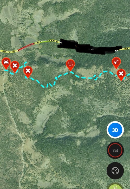
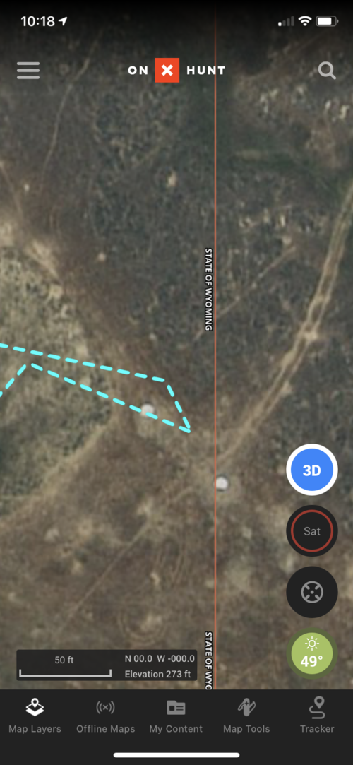
Seems like most of the forest service GIS data is off for the middle portion of our state. Lots of property lines are shifted west by around 25 yards. You can see it in the cutover lines from timber section to timber section. If it were just one, I'd write it off. But it's like an entire national forest's worth of data. And its not OnX's fault, I checked the actual county GIS data and the state KMZ files and they're off as well.
 
So If you did happen to shoot a deer on public and it did die in the yellow part of the ag land would you possibly risk your gun, truck, fines, loss of hunting privilege's to recover it?
I guess Colorado must be different. If this were Wisconsin, yes I’d go get the deer. Here the warden couldn’t take all your gear/fine/privileges for the hypothetical offense as you shot the deer on public land and OnX shows the dead deer is on public land. In addition, my thoughts assumeyou haven’t committed any other “infractions” and present landmarks don’t clearly indicate you’re over the line.

If it were determined that the lines on OnX weren’t quite right, which would necessitate corner pins, you’d probably get a talking to and MAYBE a trespassing ticket from the sheriff.

My position above is based on multiple interactions with LEOs as it pertains to other people committing offenses and specifically last weekend. 5221E4BA-4448-4A8F-8C75-ACE3C1A6CEAB.jpeg5857CF69-43E7-4E52-81DC-E23B1A694C21.jpeg
Found that bait pile on my parents land which is over the 2 gallon limit - a wildlife/hunting violation. The warden basically said he wouldn’t come out for a couple of pumpkins and we needed to go through the sheriff first as this was really a trespassing issue. The warden said he might come out and take a look if that didn’t work. Mind you the sheriff had already warned the offender about trespassing in the past, which I explained to the warden. My thought was that maybe the guy would listen to the warden. I received a lecture from the warden about how they can’t enforce trespassing, which I knew.

The OnX marker is the camera location on the wrong side of the line. The bait pile was 15 yards further in.

Called the sheriff and he came out and found the guy. He was told to get off and stay off. No tickets issued for trespassing or over baiting or damage to property for the shooting lanes cut . . . The sheriff mentioned that anything on our property, ie stands, cameras etc is ours. Next time the cameras and stands are mine.
 
Not dealing directly with the public/private interface, but down here where some of the Tax Assessors and Clerk o Courts offices are still on very antiquated systems it can be a mess. My own land as well as a lot of family land that I have personally checked via OnX has owner info as well as boundaries that do not match the survey markers that were placed.

On one parcel in particular that we just had surveyed and abstracted independently of the survey, the previous surveyor screwed up the plat so that it didn't match the legal description and everything that my great grandfather owned in that section was out of whack. OnX of course reflected the faulty boundaries.

I have also seen some property boundaries that border navigable waterways look very suspect both here at home and in Montana.

As wllm1313 said earlier, crap in, crap out.

 
I guess Colorado must be different. If this were Wisconsin, yes I’d go get the deer. Here the warden couldn’t take all your gear/fine/privileges for the hypothetical offense as you shot the deer on public land and OnX shows the dead deer is on public land. In addition, my thoughts assumeyou haven’t committed any other “infractions” and present landmarks don’t clearly indicate you’re over the line.

If it were determined that the lines on OnX weren’t quite right, which would necessitate corner pins, you’d probably get a talking to and MAYBE a trespassing ticket from the sheriff.

My position above is based on multiple interactions with LEOs as it pertains to other people committing offenses and specifically last weekend. View attachment 164922View attachment 164923
Found that bait pile on my parents land which is over the 2 gallon limit - a wildlife/hunting violation. The warden basically said he wouldn’t come out for a couple of pumpkins and we needed to go through the sheriff first as this was really a trespassing issue. The warden said he might come out and take a look if that didn’t work. Mind you the sheriff had already warned the offender about trespassing in the past, which I explained to the warden. My thought was that maybe the guy would listen to the warden. I received a lecture from the warden about how they can’t enforce trespassing, which I knew.

The OnX marker is the camera location on the wrong side of the line. The bait pile was 15 yards further in.

Called the sheriff and he came out and found the guy. He was told to get off and stay off. No tickets issued for trespassing or over baiting or damage to property for the shooting lanes cut . . . The sheriff mentioned that anything on our property, ie stands, cameras etc is ours. Next time the cameras and stands are mine.

Our wardens must have more leeway than up there. They can cite for pretty much anything a deputy or trooper can.
 
As wllm1313 said earlier, crap in, crap out.


Exactly, your phone GPS will put the OnX 'blue dot' within a few feet of where you're standing, it's pretty darn accurate. But, the level of care the county data has been maintained at is where the problem can begin. Most places I've been here in Colorado seem to be pretty fairly accurate (although the folks posting 'their' land are definitely not). I was going to pay a surveyor after buying our property but used OnX and got within ~3' of all my corner pins.
 
I have also seen some property boundaries that border navigable waterways look very suspect both here at home and in Montana.

"So I told the guy lets make my property boundary the river"- Farmer Ben

"The river... which stays in the same place every year...? - Farmer Joe


"... " -Farmer Ben

"..." - Farmer Ben

"F%^&K" - Farmer Ben
 
Here's another example of how off it can be. The two waypoints are survey monuments (Brass Caps). In my opinion, this is one of the biggest challenges to corner crossing. There are too many situations where if you used GPS only to corner cross, you would have absolutely trespassed.

Capture.JPG
 
OnX is at the mercy of two things (as are any other "mapping" apps):
- Accuracy of the property info they pull from public record - the older the property the more likely this is to be off.

- Accuracy of the GPS in your phone

I've found it VERY accruate where I live/hunt. Fence lines are right on the spot for boundaries and things like roads are right where they say they are.

I did have a conversation with the local warden and asked him about corner jumping and trespass. In general he said they use OnX when called by a landowner to establish trespass or not. But corner jumping he said don't do it unless I find the actual official corner marker/post because OnX/GPS may be off by feet and then you did tresspass. If you can find the corner marker and cross there, the local DA won't prosecute.
 
Here's another example of how off it can be. The two waypoints are survey monuments (Brass Caps). In my opinion, this is one of the biggest challenges to corner crossing. There are too many situations where if you used GPS only to corner cross, you would have absolutely trespassed.

View attachment 164934
There is a certain degree of "smell test" to all of this ^ to me that's obviously just a mapping error just looking at the screen shot. If I was a warden I'd assume people could figure that out, the OPs example I definitely wouldn't ticket for either way.
 
OnX has been good enough for me on my phone. I suppose if I really required accuracy within an inch I would probably invest more than $30 a year (less any awesome discounts of course) for a single state to use on my cell phone in an app that in itself is a free download. US Military I imagine spends millions for that accuracy. I prefer not to. As others have stated preseason scouting can verify those issues ahead of time and if inept government workers put in the wrong information I am not going to blame a GPS app company for that.
 
Onx cost me a crack at a huge bull this fall. I glassed the bull from over a couple miles away the evening before the season opened. He was in an area I had never been in before. When looking at the trail on Onx it looked like the trail wasn't close to the clearing the bull was in. The next morning in the dark I couldn't even find the trailhead. After wandering around in the dark I finally found what I thought was a game trail. It actually ended up being the trail I was trying to find. I was late getting down to the clearing and a guy from the bottom beat me to the herd. He shot a spike and blew them all out of there. Hopefully that big bull made it and will be back there next year now that I know where the real trail is.
 

Attachments

  • IMG_8100.jpg
    IMG_8100.jpg
    470.4 KB · Views: 19
Last edited:
I had a very similar situation in Idaho last year. A good chunk of wheel line irrigated pasture was in fact BLM land (and also had some good mule and whitetail deer in it every day). I had been told prior from a handful of people that the landowner was not a reasonable person at all, and to stay away from it. It just so happened that, that evening about a half mile away I ran into the warden. So I presented the situation to him to get his take on it. He said "looks to me like he's (the landowner) farming OUR public land". He went on to tell me "that if there's a deer standing in that yellow chunk of BLM, he's free game." He also said "if you shoot a deer there you better make sure he's DRT. Because if he goes into the private landowners property to die I can't even recover him for you." The warden then further explained to me how much of a gem the landowner was. Bottom line, if its BLM, especially in your situation I wouldn't hesitate at all.
 
Onx cost me a crack at a huge bull this fall. I glassed the bull from over a couple miles away the evening before the season opened. He was in an area I had never been in before. When looking at the trail on Onx it looked like the trail wasn't close to the clearing the bull was in. The next morning in the dark I couldn't even find the trailhead. After wandering around in the dark I finally found what I thought was a game trail. It actually ended up being the trail I was trying to find. I was late getting down to the clearing and a guy from the bottom beat me to the herd. He shot a spike and blew them all out of there. Hopefully that big bull made it and will be back there next year now that I know where the real trail is.

Definitely an example of OnX falling down on the job. You should call and complain to the guy/gal who is in charge of walking every single USFS trail every year to make sure the map they were given by the USFS has it in exactly the right place...or just get up earlier so the other guy doesn't get there first, because that sounds like what the real problem was.
 
This is about as close as I care to shave the line.
 

Attachments

  • E747C816-0D9A-4A93-99C6-29C8019F1301.png
    E747C816-0D9A-4A93-99C6-29C8019F1301.png
    3.7 MB · Views: 15
I was walking 100 feet inside the boundary between forest service and private in the dark according to Onx this fall. as I scanned side to side with my headlight I caught a reflection up hill of where I was by about 15 yards. You guessed it, I was on private.
What was the reflection object that caused you to determine you were on private? Survey marker?
 
Back
Top