
It’s not just corner hopping…

If it would have no other legal access than thru the BMA enrolled deeded land, then yes, they can control it.
To clarify, they can choose weather or not to allow you through their land to access a state section, but if they allow you on their land that is adjacent to a state parcel, they can't prohibit you from crossing the fence to state, can they?
 
You can access any state piece with legal access (ie. county road, etc.) regardless of what that map says.

If it would have no other legal access than thru the BMA enrolled deeded land, then yes, they can control it.
That is incorrect. It’s been tested out here.
 
Tried to take my kid there last year for the jr hunt, figured since I had smashed a few vehicle front ends over the years in that stretch on deer there were probably some deer down there. Then I discovered you can’t access it there. Nonsense. Crazy.
 
That is incorrect. It’s been tested out here.
You (or whoever) was cited with trespass?

They can keep you from driving on it, IME they cannot keep you from accessing if it's from a legal road.

Edit: I guess, technically, the DNRC could change the access regulations associated with certain sections of state (in short range weapon only hunting, etc.). I also know that they can require notification (not permission) depending on what ag operation is leasing the section for.
 
Last edited:
You (or whoever) was cited with trespass?

They can keep you from driving on it, IME they cannot keep you from accessing if it's from a legal road.
IMG_7517.jpeg
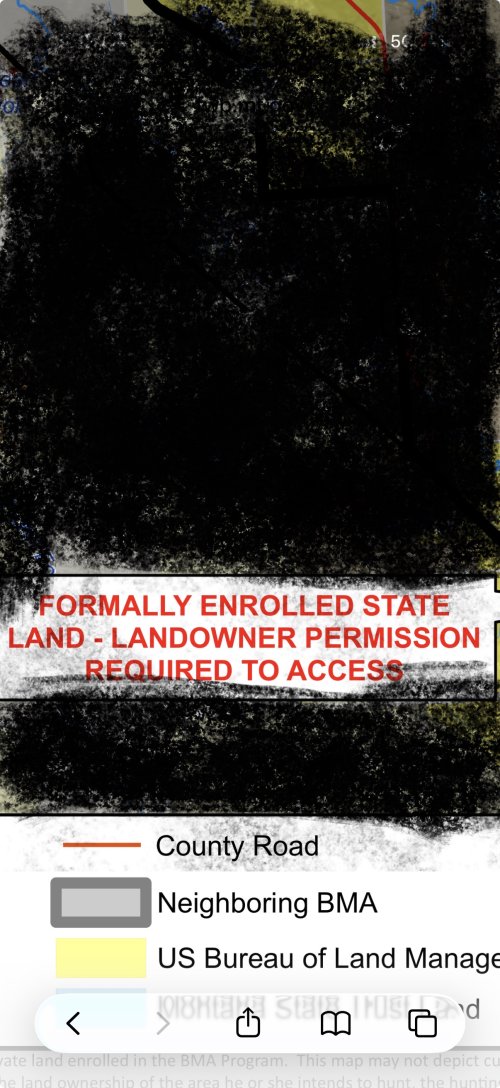
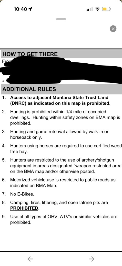
I am not going to name the bma but I know for fact an elk was shot on accessible state enrolled in this bma. The hunter was not allowed to recover the elk and a warning was issued. That is just one instance I know of many more.
 
To clarify, they can choose weather or not to allow you through their land to access a state section, but if they allow you on their land that is adjacent to a state parcel, they can't prohibit you from crossing the fence to state, can they?
Another one I drive by all the time. The state land is otherwise inaccessible and would be phenomenal whitetail and elk hunting. That’s why it’s hunted by the neighboring outfitter and the public isn’t allowed to cross from the BMA.

IMG_6290.jpeg
 
View attachment 418315
I am not going to name the bma but I know for fact an elk was shot on accessible state enrolled in this bma. The hunter was not allowed to recover the elk and a warning was issued. That is just one instance I know of many more.
I feel like thats pretty shaky legal ground, if the bma funded some of the state trust from the state land, i would at least sort of get the logic. What could they charge someone with? Trespassing on state land? What kind of jury would buy off on that?

Pretty easy way to make a mistake in my opinion, if your bma layer is turned off you could reasonably have no idea that the state land must be signed into via bma.
 
So if I understand it correctly, a publicly accessible parcel of state ground, that I can access any other time, becomes inaccessible unless I have permission during hunting season because a landowner can formally enroll that parcel into their BMA.

Is that correct?

Correct. I just looked and the particular land is no longer enrolled. Otherwise I’d post it up
 
I feel like thats pretty shaky legal ground, if the bma funded some of the state trust from the state land, i would at least sort of get the logic. What could they charge someone with? Trespassing on state land? What kind of jury would buy off on that?

Pretty easy way to make a mistake in my opinion, if your bma layer is turned off you could reasonably have no idea that the state land must be signed into via bma.
I personally don't think it would hold up.
 
I personally don't think it would hold up.
Me neither - much like corner crossing, prosecution/le would rather not than risk losing in court.
Waitaminute.... I thought we already decided it wasn't legal?
It is. The ideal would be an exact pin/survey monument, imo, to remove any doubt and add credibility to the case for a hypothetical future defendant.
 
Without any idea where exactly this is...you can go to the county clerks office and ask if they will point you to the corner records. These are the records that are typically filed by surveyors when the corner was used or set as part of a land survey. The BLM would be the next stop to see when the township last had BLM surveyors. Obviously you search by township/range/section which you can get of your favorite mapping app.
 
Back
Top