

TheWanderer
Member
- Joined
- Feb 11, 2012
- Messages
- 56
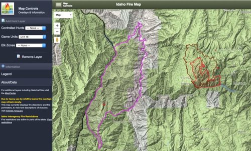
A friend and I drew lottery archery tags for Unit 18 and are leaving for Idaho friday morning and looking on InciWeb tonight I see there is a small burn in the wilderness area. However unlike the other burns I can click on anything to get details about size and expectations for this burn.
Does anyone have any information on the status of this burn. Also any logistical/logical recc's about being in a unit with active burns? Some of the spots we have picked our are in the wilderness area.
What type of distance should keep between us and this burn (in general). Are prepared to pack in and spend time at a number of our spots but do we need to pick up a radio for updates so we aren't in danger?
Thanks.