go4thebighorn
Member
- Joined
- Jan 5, 2022
- Messages
- 49
ok, will do. ThanksIf you can email [email protected], they'll be able to help you get everything working again.


Follow along with the video below to see how to install our site as a web app on your home screen.
Note: This feature may not be available in some browsers.

ok, will do. ThanksIf you can email [email protected], they'll be able to help you get everything working again.
Tap the three lines in the upper left corner of your phone screen. Under your email it will say either Premium or Elite User, or Basic User. If it says Basic User, your Membership has expired.I think my subscription has expired, but I am not sure how to verify it. Help?
Tnx.
Thanks for the reply - I have OnX open on my apple device and will plug it into the vehicle, but does not show up on my screen/Uconnect. Spotify and other applications come through like usual but haven't been able to get OnX to work.You do not need to purchase Offroad to view the map on your vehicle screen. If you have an Apple device, it should show up on your dash screen when you connect your phone. Android auto is not available just yet, but it is coming soon.
Can you double check that you are on the most up to date version of the App. Sometimes if you are on an older version, the app will fail to show on your screen. If you're still not seeing it there, your best bet is to send us an email at [email protected] and we'll be able to dig in a little deeper and get things figured out for you.Thanks for the reply - I have OnX open on my apple device and will plug it into the vehicle, but does not show up on my screen/Uconnect. Spotify and other applications come through like usual but haven't been able to get OnX to work.
It depends on your area, as our regular imagery provider typically captures new imagery for about 1/3 of the country a year, so imagery being 2-3 years behind is typical. However, we're working on some new imagery options that will be updated much more often (like more along the lines of a monthly basis). I don't have a specific ETA for you on the new imagery options that are coming, but we hope to have that feature released very soon.When will the maps be updated? I hunt an area that has had fires and significant brush hog work done in the last several years but none of this shows up on the current maps.

That's good feedback, I can definitely see how that is frustrating. I've passed this along to our Engineering Team so that can look at making that option work better and make exporting more convenient.
if using your phone and thus the waypoints are syncing to your online account, no. just use the same login user ID email. You mentioned chip so that sounds like a standalone gps unit usage. Are you using oremium on yiur phone and have all waypoints etc on the phone?I have the Premium membership - Colorado Chip. Due to good luck in the WY elk draw, I now need the WY chip. I tried to buy it but see that you can't buy two states and that I need to buy the Elite (50 state) membership. My question is, if I do that, do I need to do anything so I don't lose all of my Colorado waypoints?
I have Premium on my Iphone and also a standalone gps as backup with chip. Thanks for the info.if using your phone and thus the waypoints are syncing to your online account, no. just use the same login user ID email. You mentioned chip so that sounds like a standalone gps unit usage. Are you using oremium on yiur phone and have all waypoints etc on the phone?
There are some great free add- on benefits thatcome with elite membership, toprut.com and huntinfool are two.
you just missed a mothers day 30% off (I think?) sale on elite. There are other deals to be had, just look around.
nopeI didn't read through all 43 pages of this thread. I hope this hasn't been asked before.
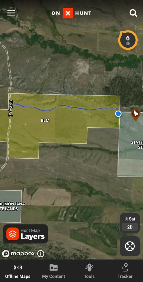
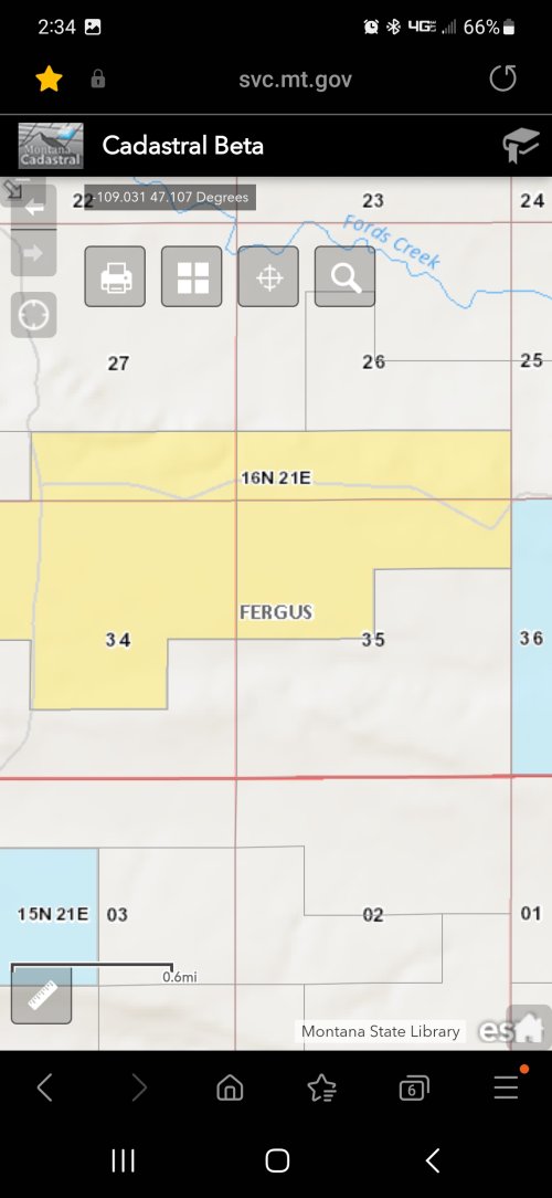
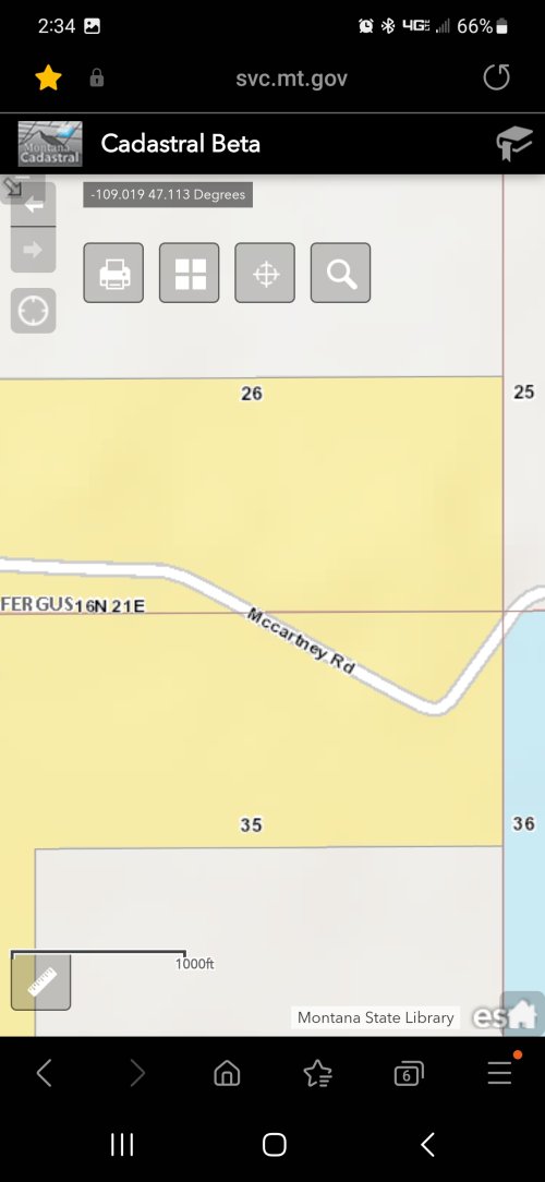
Is there a way that I can find out the date that the satellite image was taken?
Thanks
Unfortunately, I don't have any update on that for you. It is a priority for us to get that out as soon as possible, and we certainly want to have it available before hunting season. I will post more information in this thread as it becomes available.Any words on when Onx will work with Android Auto?