kwyeewyk
Well-known member
We have pretty good access to both Gohunt and onx through this forum, I'm sure they'd be willing to give you an answer if you asked them directly.


Follow along with the video below to see how to install our site as a web app on your home screen.
Note: This feature may not be available in some browsers.

Totally agree that nothing replaces hard work. But if your "homework" is done for you AND IF there is an ability to get live updates from the current hunters in the field it's hard to imagine that if there is a group that has this option to access this data that "work smarter not harder" could be at play. Very interesting to consider that 10 different hunters would approach the same given waypoint 10 different ways potentially.This is an interesting thread. I know the folks at both GOHUNT and onX very well. I've discussed with both the possibility of a data breach. They are smart folks and they realize that importance. So, they place a huge amount of resources to prevent such. Yet, it is technology, so there is not bomb-proof guarantee.
A funny part somewhat related to this waypoint/coordinate topic is when Marcus places "easter eggs" in some of our content. An "easter egg" is when we have a segment that might show some sort of coordinates. We insert coordinates to a shopping mall, out in the middle of the Pacific, or maybe our office coordinates. When we do that we almost always get a few emails that could be summarized as being PO'd that we didn't give true coordinates. We've had folks contact our sponsors complaining that I wouldn't give them coordinates, drainages, etc. I just laugh.
Given how much people gain from our film permits, when they see us in the field and post such encounter online, I don't hunt with anyone in their "honey hole." That has also reduced the level of "intellectual property" I feel in my huge pile of waypoints.
I suspect if a Hunt Talker who is consistently successful on public land gave me their best waypoint, I'd probably get skunked in a week of hunting, barring some sort of lucky encounter. I likely don't have their knowledge of the area or understanding of how animals use that area. Folks who are continuously successful on highly pressured public land are successful because of their hard work and their research. Send ten people to the same waypoint, and I doubt they'd have the success the hard working hunter has.
Would you rather pay $100 per year or $100 once? They used to sell regional chips that included 4-5 states. I assume they figured out it’s better to charge people $100 every year instead of $100 once, so they don’t sell the regional chips anymore. The forest service and blm boundaries don’t change frequently enough to need new data every year, and if you’re going to a questionable area then buy the BLM surface management map to double check.
So so many golden waypoints that the sun is dimmer because of them!This thread is hilarious, you all must have some golden waypoints, but if you're that paranoid about technology better cancel your internet, just think what the IT pervs at tiktok are doing with videos of your kids! I'm sure they can turn the camera on anytime they want.
Yes, yes they do.Had an issue with my phone not loading waypoints so I called customer service.
After discussing a few specific waypoints o can say.
They definitely have access to all waypoints, labels, symbols and pictures.
Send ten people to the same waypoint, and I doubt they'd have the success the hard working hunterhashad.
")


The service is a steal at $100.Would you rather pay $100 per year or $100 once? They used to sell regional chips that included 4-5 states. I assume they figured out it’s better to charge people $100 every year instead of $100 once, so they don’t sell the regional chips anymore. The forest service and blm boundaries don’t change frequently enough to need new data every year, and if you’re going to a questionable area then buy the BLM surface management map to double check.
That's a great perspective. I think the new clusters are interesting and possibly a way to zig when everyone is zagging. I'm not concerned with OnX or whatever stealing my waypoints. Take em' for all I care. It's just the whole process and the idea that of how it could be very beneficial for someone. But yeah if someone takes my waypoints. Have fun on your armed hike.I had the same concern the first year I used OnX mobile. Then I thought about it for about ten minutes.
If they looked at all my waypoints and only MINE, they would know where I hunt. That wouldn’t do them any good unless they knew if I was successful, and saw large enough animals to interest them. From that standpoint, 90% of users have waypoints that are little more than worthless crap.
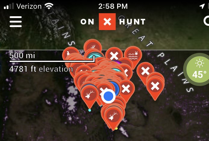
Another way to analyze it would be to look for clusters. Now how do we interpret the clusters? They are certainly places where a lot of hunters go. Is that good or bad? What about the spots only a few hunters go? Are they the geniuses or the idiots? What about places no hunters go? I’m sure that topo and satellite imagery would show you why the different concentrations of waypoints were what they were, but then would you really need the waypoints?
What about famous hunters? Or outfitters? Well, some famous hunters aren’t turning up big nice animals every year on public land. I’d wager that most of the guys who do that are not famous. Outfitters might turn up some useful information, but of course, now you’d be hunting beside outfitters.
I honestly think the only way for them to glean anything useful from it all would just be to look at a unit they had already drawn, and see if any NEW clusters of waypoints popped up between the draw and shortly before the hunt, and all that would tell them is where people who drew that same unit might be planning to hunt, and thus you could perhaps avoid the crowd. But what season are they hunting? What species?
Anyone worried about OnX stealing their data for HUNTING purposes is worrying too much about nothing.
They can have at my “secret” spot….I have more spots than time.That's a great perspective. I think the new clusters are interesting and possibly a way to zig when everyone is zagging. I'm not concerned with OnX or whatever stealing my waypoints. Take em' for all I care. It's just the whole process and the idea that of how it could be very beneficial for someone. But yeah if someone takes my waypoints. Have fun on your armed hike.
Looks like mineThey can have at my “secret” spot….I have more spots than time.

 .
. HA! Jokes on them…my name isn’t Bob.Seriously does anyone actually have a big bull bedded point? SMH
Honestly, if we are talking worst case scenario here, a company like OnX would be selling your tracking data to google who combines it with other data to create a profile of you.
Oh look, Bob buys donnets, drinks bud heavy, has a 4wheeler on credit, and doesn’t show any walking/hiking movement. He’s probably going to die of a heart attack, deny any apps for life insurance, increase his health insurance premium, and target adds for various blood pressure pharmaceuticals.
Anyone worried about OnX stealing their data for HUNTING purposes is worrying too much about nothing.

“Spots” of guys who are worried about their waypoints…I think really the depth of this thread lies in remembering a couple things.
1. Good people with good intentions can think they are doing good until they aren’t. This is where accountability comes in.
2. Just because you think they aren’t doesn’t mean you shouldn’t still question whether they are. Think about it
3. The best tools created with the best intentions can also be used for the worst. History & mankind have proven this over & over.