Hunt Talk Radio - Look for it on your favorite Podcast platform

How accurate is OnX?

Fences don't mean much without a survey.
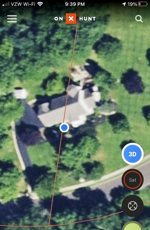
Gps and mapping tech is not a substitute.

If you want to push boundaries be prepared to be the guy who pays for the survey.
 
Definitely an example of OnX falling down on the job. You should call and complain to the guy/gal who is in charge of walking every single USFS trail every year to make sure the map they were given by the USFS has it in exactly the right place...or just get up earlier so the other guy doesn't get there first, because that sounds like what the real problem was.
I know a waste of my tax dollars buy the USFS. Always got to be one of those guys... In fact I did get up extra early. I was just stating the fact that you can't always trust Onx or any other mapping program if you are there or e-scouting.
 
There is a certain degree of "smell test" to all of this ^ to me that's obviously just a mapping error just looking at the screen shot. If I was a warden I'd assume people could figure that out, the OPs example I definitely wouldn't ticket for either way.
Just showing how off it can be in certain instances. I use the technology almost daily while at work (Natural Resource Field Manager) and play and spend more days in the field than most. From my experience, it is rarely the case when the mapping technology or recreational GPS put a corner in the same place as a survey monument. I agree it is obvious to most but still leaves doubt and uncertainty for some.
 
In my experience, it's not 100% accurate. I use it more for generalized information and not fine detail. I thinks it's usually best to use fence lines, or other visual evidence that's actually visible on the ground. For instance, a property my Dad owns shows up on OnX as a rectangular shaped parcel, but I know from experience with the actual survey markers that it's really triangular. Another area I hunt is on state forest land. The forest boundary is well marked with signs and white paint on trees. The difference between OnX and the signs in the forest is approximately 100+ yards.
 
It really is dependent upon where the data is drawn from. This is my property, and as you can see, the property line goes right through the middle of my house on OnX and also the state GIS site LOL. Obviously it’s quite a bit off!
 

Attachments

  • C2100FE0-66E9-45D4-B306-AD015459CF0A.jpeg
    C2100FE0-66E9-45D4-B306-AD015459CF0A.jpeg
    209 KB · Views: 5
Responding to OP. I would say that the mapping is highly accurate, but that is going to depend on where you live. I live in Alaska, relatively few property lines to keep in mind. However, have used onX in NE,MT,MI, CO, and WY as well and have yet to be led astray as far as using the overlays on the maps to determine where boundaries are, etc. The topo overlaid on a satellite image has been my go to, you can get in trouble doing escouting without using 3d imaging (google earth 3d is a joke imo). I got myself cliffed out going into a new unit for goats this past season because it looked doable on the the maps and on google earth but the mtn was riddle with impassable cravasses that you could only see in high-res 3D. I have heard that onX is beta testing 3D, but I've yet to see it.

In terms of how closely the app will track and pin point you, that will depend on your phone/gps, and the quality of your connection to the satellites overhead. I have had good luck with marking my location and tracking my route, the orientation arrow does get pretty off sometime though, but again, that could be the hardware not the software. The one troubling issue I have had recently is the tendency for the app to open and none of my waypoints or tracks show up, if I restart the phone that will fix the problem, but it is inconvenient.

Hope this helps.
 
I don’t think it’s as accurate as some of its competitors. But I also don’t use it as a land survey. I use it as a tool. You’re supposed to know where you’re hunting/hiking/fishing....whatever.
 
I have a buddy that surveys. He has it on his phone and uses it for reference. We also used it hunting the other weekend and we went by it.

Now with the pictures showing property lives going through houses. He is surveying and area thats all messed up. Fences in the wrong places and buildings on other people's land. What they're going to suggest is everyone just signs something to say they agree they'll just make the current fence lines the actual property lines. Otherwise everyone's going to have a huge headache.

I also checked and my family's cabin, who's property has been surveyed a few times, has the lines not exactly right, but they're within 10/15 feet right.

I also have been told by a warden to one OnX and that he uses OnX to determine lines.
 
As a former surveyor/GIS tech., I use the ON X boundaries as a reference rather than an absolute. In general they are fairly close, however, I have seen GIS data vary from the actual verified survey monuments by several hundred yards. It's the hunter's responsibility to know where they are, NOT ONX's.
 
I have seen GIS data vary from the actual verified survey monuments by several hundred yards.

Adding to this "survey" is just a matter of opinion, high refined and supported, but not an absolute.

I ran a project in PA; it was huge, basically all of Greene county. County data was crap, our leased acres were wildly off. My theory was that 19th century surveyors didn't take trigonometry into account, essentially a 1 mile by 1 mile flat piece of land is 1sq mile, but if the say there is a mountain in the middle and you calculate surface area based on the hypotenuse of then all of a sudden that same parcel is more than 1sqmile. Could have been projection, or other various types of errors, but everything was egregious off, 100 acres platted and measured 64 acres, and it was virtually every tract.

1607277932791.png

Needless to say when we took a lease and paid a bonus on 100 acres and then folks got their royalty check, after we formed units and surveyed everything, that royalty was paid on the survey acreage which was 64 acres and let me tell you people were pissed.

We ran a bunch of different survey crews in order to get everything mapped correctly and in a timely manner... and guess what, it's pretty much impossible to get surveys from different companies to match. One companies line was 5-300 ft off another companies line. I ended up providing "hard points" that each company had to tie to... well CAD users 🤦‍♂️ (Yes, you have to use a projection in CAD it's not optional). This isn't a PA issue, I've run into it everywhere Texas, Oklahoma, Colorado, West Virginia... "survey accuracy" doesn't mean anything. In 10 years working with dozens of surveyors I have never had two surveys match point to point, EVER. This only happens when I run a project and request that the entire thing is done in the same database, ie, "Listen I want all the parcel boundaries to match, if they don't you are doing it again for free"

Anyway massive undertaking and we spent a shit load of money. Rural western counties, whose citizens balk at all taxes, you think they will have the man power to do this?

Between datum changes, using changing objects like rivers as reference points, adverse position laws, the vagaries of title, if you have enough money you can make boundaries kinda be were you what them to some extent. Look at the whole crazy mountain debacle.

Bonus fun with maps!

Back east you get lots of deeds with metes and bounds in Perch.

Texas is mostly varas, the exact length of a vara is slightly different depending on who did the survey. Spanish varas are 32.91 inches, Texas varas are 33 1/3 inches, California varas are 33 inches. Seems small, but if your working with 10,000 acre properties.... what's fun is when the property was a Spanish land grant and then was subdivided after the Republic was created. So 10,000 by 10,000 spreads that were original measured in one... then subdivided in other... plus your hard point is a tree, or river, or pile of rocks, or my personal hell, "For the beginning of this tract start at the most western corner of the Johnson tract described in book 504, pg 201, which is also the most South Eastern corner of the the Thomas tract described in book...." then when you pull the Johnson deed, "For the beginning of this tract start at the most Eastern corner of the Williams tract described in...." :mad::mad::mad:


Plat maps/tobin maps/ etc were not projected, essentially they are just really nice scribbles. You can't actually digitize these.

1607279253707.png

There are other mapping services, but at the end of the day for nation wide, for public use OnX is the gold standard. The USFWS specifically tells hunters to use them.

And not just out west.
1607279549488.png

Probably the only better service IMHO, that has nationwide or close to it coverage is WhiteStar.
 
Last edited:
I often wonder what we can do about outdated property info that appears public and is not posted?
 
Caribou Gear

Latest posts

Forum statistics

Threads
110,817
Messages
1,935,471
Members
34,889
Latest member
jahmes143
Back
Top