Straight Arrow
Well-known member
Dean Lake, Pentagon Mountain - Bob Marshall Wilderness


Follow along with the video below to see how to install our site as a web app on your home screen.
Note: This feature may not be available in some browsers.


Outdoor Writer passed away yesterday. Maybe sitting in the alpine somewhere today.This image was taken on infrared film in the Weminuche WA. Colo. Rock Lake is in the crater.
View attachment 222526
I hope it's sunny with a light breeze to keep the bugs away.Outdoor Writer passed away yesterday. Maybe sitting in the alpine somewhere today.
He posted a lot of really cool photos over on the 'slide in the last few years. He'd obviously had a lot of really good experiences in the outdoors.Outdoor Writer passed away yesterday. Maybe sitting in the alpine somewhere today.

I've spent the summer doing many activities i missed out on last year. Also been busier than heck. Pretty annoyed I didn't get any solo climbs in...might be the first year in my adult life I didn't.View attachment 238046
From our family backpacking trip a couple of weeks ago. You can basically see all of the WA crest from here.
Red is the Enchantments (most popular alpine area in WA), with the red dot representing Mt. Stuart (9,209')
Black dot to the right of the Enchantments is Mt. Adams (12,287') approximate 33 miles from the OR border.
Blue line is Mt Rainier (14,409')
Green line is Mt. Daniel (7,884'), the most heavily glaciated non-volcano in the Alpine Lakes Wilderness (and central WA in general).
Yellow Line is Mt. Baker (10,420') approximately 15 miles from Canada.
Cyan line is Glacier Peak (10,433'), the next on my hit list.
I failed at the furthest two peaks in that pic above about three hrs after I took the pic, they represent the two highest peaks in this particular range. I didn't read up on either and discovered that it's fairly simply to get close to the summit, but very sketchy to get to it. I also had the dog in toe, and when he started to struggle, and I had to lift him from ledge to ledge, I decided that was probably pushing it a little too far.I've spent the summer doing many activities i missed out on last year. Also been busier than heck. Pretty annoyed I didn't get any solo climbs in...might be the first year in my adult life I didn't.
But I have plans for next year to get back on track.
Can't do it all sometimes.


I love being in the mountains but I have zero interest in exposure like that.I failed at the furthest two peaks in that pic above about three hrs after I took the pic, they represent the two highest peaks in this particular range. I didn't read up on either and discovered that it's fairly simply to get close to the summit, but very sketchy to get to it. I also had the dog in toe, and when he started to struggle, and I had to lift him from ledge to ledge, I decided that was probably pushing it a little too far.
View attachment 238051


You and me both. I hate it, truly hate it. Won't rock climb at all because of it. But I also feel like I have to keep pushing myself into those situations from time to time to keep that fear from controlling me. It might bite me one day, but there are worse places to die.I love being in the mountains but I have zero interest in exposure like that.

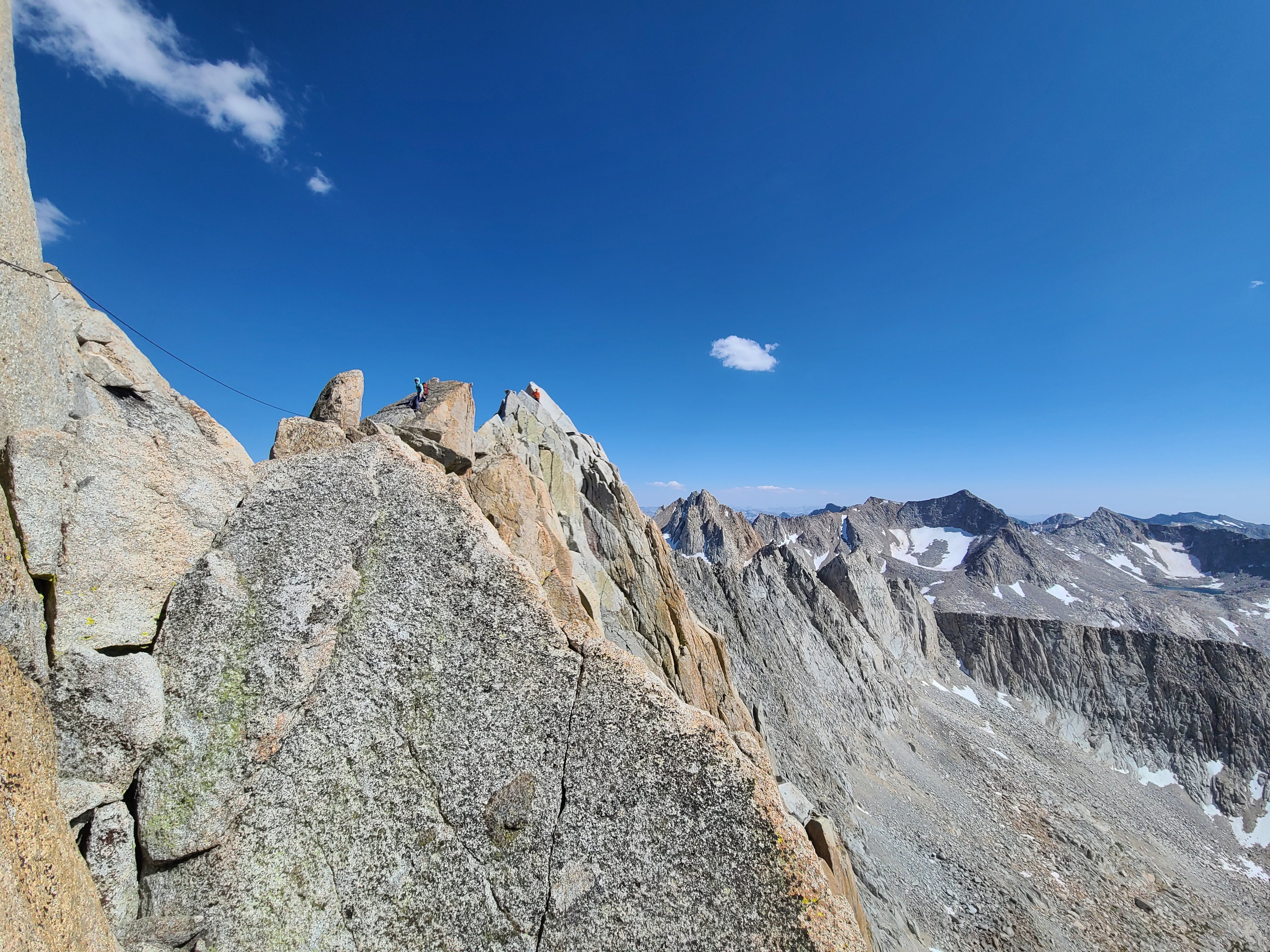
... far enough that I'm glad it can't convey it is the correct answer.
long ridge scrambles are one of my favorite things, I fall on the other side of the spectrum though, the more exposure the better, hard to convey in a photo just how far off the deck this is...