Hunt Talk Radio - Look for it on your favorite Podcast platform

Smartphone GPS Apps

EODRay

Active member
Joined
Sep 26, 2012
Messages
586
Location
Colorado Springs, CO
I did some searching but couldn't find any current information.
I was wondering who has used and would reccomend good GPS/Hunting apps for smartphones. I have a IPhone 3G. I found several in the Apps store and bought the MotionX GPS because of the reviews. I haven't had a chance to use it to see how accurate or good it is. I plan on taking it with me on my Elk hunt (have a Magellin as well) next week and will know more then.

I just thought that if anyone here has used and liked some others, I could try those out as well. It seems if any of them work well, they would be a lot cheeper (free) and easier to get maps of any area I wanted. So how about it, what have you used?
 
I use Cabela's Recon Hunt. It does everything a standalone GPS unit does (it comes with free USGS topo maps) and has some nifty added features like a ballistics calculator. It costs $5 for android devices so I'd suspect it would be similar in the app store.
 
Last edited:
A friend tried using the gps function of google earth on a hunting trip and drained his battery in short time.

Problem with using gps on phones - that function was designed for vehicle street navigation with the unit plugged in. Out in the woods, it's my opinion one is better off with an actual gps unit... thick battery and all.
 
Sytes is absolutely correct. My Garmin eTrex finally died this elk season and I was forced to use my phone as a backup. While the phone and the app worked way better than my ancient eTrex, the battery got chewed up horribly fast. Luckily we weren't camping away from my truck so I was able to recharge it twice per day.
 
I use Cabela's Recon Hunt. It does everything a standalone GPS unit does (it comes with free USGS topo maps) and has some nifty added features like a ballistics calculator. It costs $5 for android devices so I'd suspect it would be similar in the app store.

Yep, it's 4.99 at the APP store and I now have it.
I was thinking about buying an Iphone charger that you can put regular batteries in for the dying issue. I will try to only use the GPS function when navigating and stay in Airplane mode otherwise. I will of course have a map n compass as well as another GPS with me.
 
Try out Backcountry Navigator Pro...$9.99 for my Android. There are also state specific BLM and GMU layers available as add-ons.
 
My brother and I recently used Backcountry Navigator Pro ($10) on our Samsung Galaxy S IIIs for 10 days. Far and away better than anything I've seen on standard GPS unit. I can toggle between 24k Topo and satellite imagery, and do everything a regular GPS can do (waypoints, measure distance, track path etc.) can do.

Having a 2.5" x 4.25" high resolution screen didn't hurt either.

Once set to airplane mode, the unit worked all day with plenty of battery life left. We charged and night and were good to go. My brother also had additional batteries if needed since they're only $25 bucks.

My phone is a sunk cost, toss in $10 for the program and $25 per battery, I've got a pretty slick GPS unit for $35-60 bucks.
 
Jryoung, my android does not have an ability to function in airplane mode for GPS.

Are you using the phone screen as a map only or is there a new feature for GPS use in airplane mode?
 
Not sure of the app name, but buddy downloaded one when we were in Wyoming. It showed all the property lines of public and private. I'm pretty sure it was Cabelas something. The differences between it and the GPS with a chip:

1) It doesn't show land owner names.
2) It can only locate you when you have data service.

It was a few dollars for the app, and $10 a year for a subscription. It had a 9 day free trial so he didn't have to subscribe.
 
My brother and I recently used Backcountry Navigator Pro ($10) on our Samsung Galaxy S IIIs for 10 days. Far and away better than anything I've seen on standard GPS unit. I can toggle between 24k Topo and satellite imagery, and do everything a regular GPS can do (waypoints, measure distance, track path etc.) can do.

Having a 2.5" x 4.25" high resolution screen didn't hurt either.

Once set to airplane mode, the unit worked all day with plenty of battery life left. We charged and night and were good to go. My brother also had additional batteries if needed since they're only $25 bucks.

My phone is a sunk cost, toss in $10 for the program and $25 per battery, I've got a pretty slick GPS unit for $35-60 bucks.

Sounds cool. Does it show public lands at all, like state, blm, and usfs?

Do you need to have service for it to work?
 
Jryoung, my android does not have an ability to function in airplane mode for GPS.

Are you using the phone screen as a map only or is there a new feature for GPS use in airplane mode?

On my phone, cellular, GPS, bluetooth and wifi are all independent of one another. Airplane shuts down the cellular and bluetooth. GPS and Wifi still function.

For using the maps I run as little as possible for battery life. Set airplane, turn GPS on, dim the screen if I can.

Mule Deer said:
Sounds cool. Does it show public lands at all, like state, blm, and usfs?

Do you need to have service for it to work?

For right now the Topo shows FS boundaries and "other". By other I mean it is shaded another color but no indication of what the land ownership is. Since I also have BLM and FS maps of the area they cover my landownership issue (if I can hunt it or not). Used in conjunction with paper maps, and google earth/maps this function is super slick.

You don't need cell service, but you must download the area you are going to hunt in while at home (preferably over wifi). My advice is to select an area significantly larger than where you will be (in the event you have to chase a wounded bull for several miles) for download. Grab both the topo and satelitte images (sat images are significantly more data but quite worth it).

Your phone pulls the map/sat imagery from your memory then the GPS layers on your position over the top.

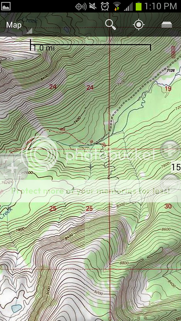
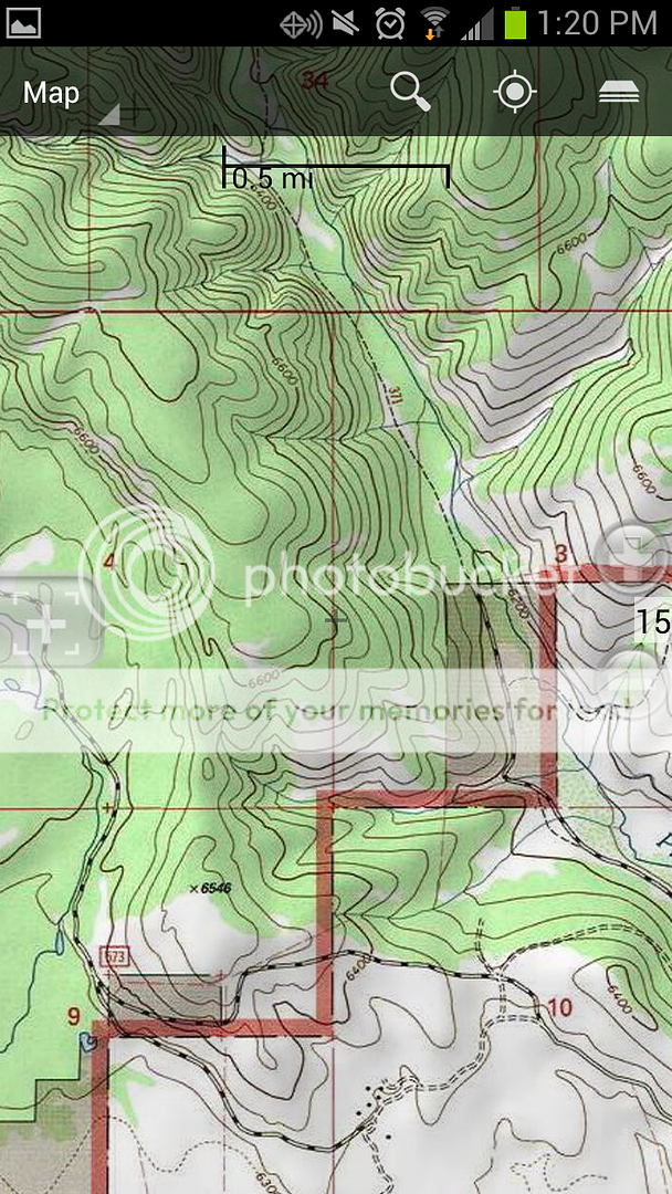
Here are some screen shots below.

Here I can look at an area, and determine where the trail is snaking up the hill (or determine some other piece of data).
Screenshot_2012-10-30-13-10-12.png


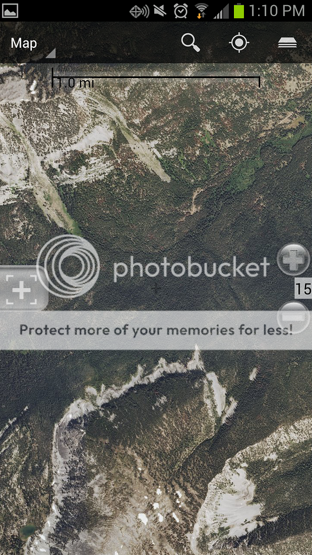
Then I can toggle between the same area, but this time from satellite.
Screenshot_2012-10-30-13-10-24.png


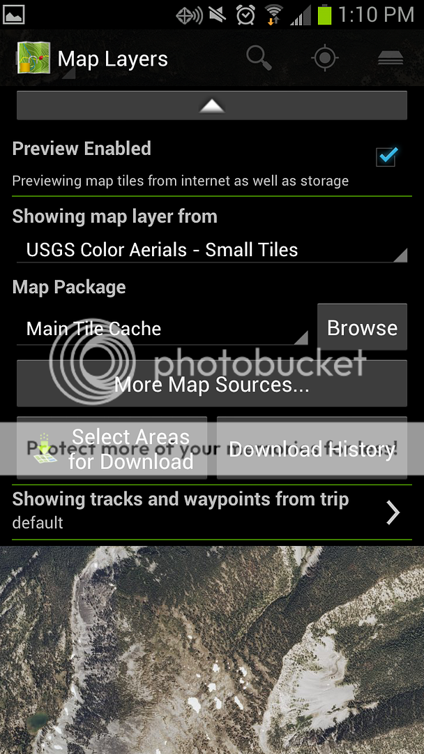
Here's a shot of the drop down menu where you can choose between your maps you have downloaded, or select areas for download if you are still in cell/wifi range.
Screenshot_2012-10-30-13-10-45.png


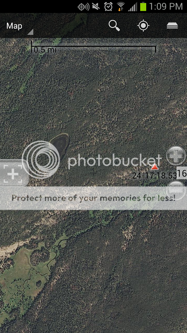
Here's a random shot of an area where I can see the creek/meadow I was looking to hunt along with an adjacent lake and the GPS waypoint I set for where I parked.
Screenshot_2012-10-30-13-09-30.png


Finally, here the NF boundary in red, you can see some darker shaded sections in the boundary, but no identification as to what the ownership is. But, like I noted earlier, if you use other resources, by the time you get into the field, you'll already know what these are.
Screenshot_2012-10-30-13-20-52.png
 
Heh, pretty darn nice! I think I'll pick that up even though I have a GPS unit. That is pretty darn slick.

I'll have to look into my phone settings... It is a Droid X. I tried the navigator in airplane mode and my time waiting - it did not pick up GPS though maybe just an off experience with the GPS.

Even to simply review the maps and surrounding areas in the vehicle is worth the money. Thanks for the info and pics.

I just upgraded from a Droid X, and in my experience airplane mode shuts everything down (cellular, wifi, gps, bluetooth). Not only that, but I also needed a recent signal from a cell tower for the GPS to work. The phone didn't have to keep the cell signal, but for some reason if the phone hadn't had contact with a cell tower within the last few hours the GPS wouldn't lock on. That made for a hell of a time getting back to a wallow I'd found earlier in the day.

Within the Cabela's app there are also settings you can use to minimize battery drain. I think it defaults to updating your position every second and/or 10 feet. I switched it to once a minute and every 100 feet and saw significant battery life improvement.

After my experience this fall I think a phone app is definitely worth a few bucks, but it's best use is for around camp. A good GPS unit is much better suited from a power and durability standpoint to be taking into the field.
 
I'll have to look into my phone settings... It is a Droid X. I tried the navigator in airplane mode and my time waiting - it did not pick up GPS though maybe just an off experience with the GPS.

Sytes, I have the EVO and in airplane mode if you go into settings/location/use gps satelites, you shold be able to toggle your GPS on and off.

As for battery life, I used the Brunton Freedom Charger

http://store.bruntonoutdoor.com/portable-power/portable-power-packs/inspire-trade-black/

I got three full charges out of it and at 5.5oz it's a no-brainer.


One thing I found out this year is that I needed to load (view) all of the maps I would possible be using while I still had data service. If not, the GPS would work but it showed me on a blank background. A great tool for not much of an investment!

-Dave
 
Definately a handy little tool. I've been using Recon Hunt and backcountry navigator for the past two years. I use them WAY more than the Gramin Oregon I got for christmas. Battery life isn't that big of an issue unless you are on an extended hunt. I can usually get two to three days off of mine in Airplane mode.

Bigest bonus for me is having sat images to use. Especially when hunting the mountains.

Side note. I kept my old phone, took the sim card out so it has no "phone" capabilities but it still works with wifi and gps, and all the apps still function normally. I just need to download all the maps before the trip. Allows me to carry it in the field with out having to worry about dropping my current phone in the water/snow/mud.

Google maps that comes loaded on all android phones will let you cache maps to it as well. Sat/topt/street the whole works. So no need to purchase an app if you don't want to.
 
I cheat:) i usually fly over the areas im going to hunt and mark my way points and scope out the bedding areas, flying at about 500 AGL you can see allot of ground features and pick the best route to enter an area, and if i can find a clear spot to land as long as its at least 300 foot of clear ground or sand bar, close to the area i want to hunt , life is even better:)
 
Use Promo Code Randy for 20% off OutdoorClass

Latest posts

Forum statistics

Threads
111,214
Messages
1,951,356
Members
35,079
Latest member
DrGeauxNewMexico
Back
Top