Hunt Talk Radio - Look for it on your favorite Podcast platform

WTH Alaska Department of Fish and Game

AvidIndoorsman

Well-known member
Joined
Dec 9, 2015
Messages
18,370
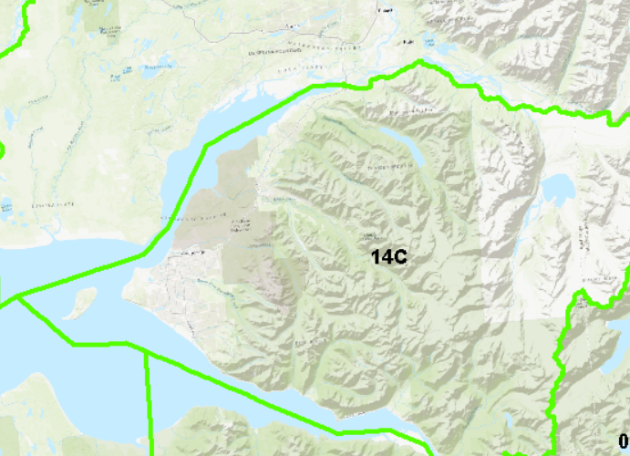
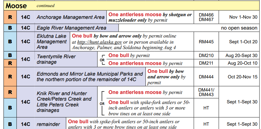
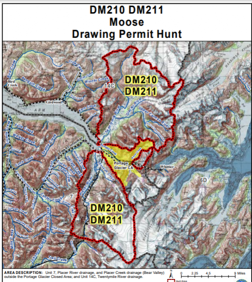
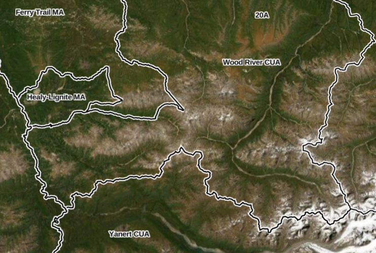
I’ve emailed a couple different people at ADFG asking for more detailed unit boundaries, essentially shapefiles/.kmz etc to use for my hunts beyond the crappy .PDFs on their website.

I have been told by every single person that they are not allowed to provide mapping information to the public.

“Any polygons shown or released by the department are not meant to be legally binding boundaries of hunts and instead the text describing the hunt boundary should be used.”

Has anyone ever encountered this in another state, not willing to give you the boundary of the unit you’re hunting?
 
That’s absolute bullshit. If they make maps of units, they have the data behind them, and they should be obligated to provide it to the public.

Maybe reach out to staff further down the line like biologists or some thing. People who aren’t aware of their org’s rules are best when trying to acquire data. 😉
5 GIS analysts, 2 bio, and a tech.

The server pathway to the .mxd is on the actual .PDFs, they absolutely know where the file is, and how to get it. This is obviously department policy.

Also why it’s not available on OnX/gohunt… obviously.
 
If you could get them to send you maps in PDF form, sometimes you can extract the underlying data out of those with different conversion tools.

Then , you can post that shit up on git, and AGOL, and everywhere else just to spite them.
It's just bizarre, I mean practically every state has a disclaimer to the effect that the verbal unit description is what's legally binding, not the map. Rivers change for instance and you are bound by the center of the river not the line of the map of what was once the center of the river.

Which is fine... so say that it's just for reference and upload the whole file Alaska.

EG. Montana
1646186166074.png
 
Last edited:
http://www.legis.state.ak.us/basis/statutes.asp?media=print&secStart=40.25&secEnd=40.25.350

I wonder if they could legally deny a written request and provide their memorandum of record regarding the agency policy?
Yeah I will look into how to file a Alaska Public Records Request this weekend. Most states have a department liaison that you send requests to but I couldn't find one for ADFG.

For what it's worth I saw a map with all the Units while with my buddy checking a goat, I asked about the file and was introduced to a employee who told me I couldn't have the file. So this isn't my first time asking, and I have done so in person with folks beyond the front desk.
 
I like maps, but I can see that you REALLY like maps. I'm not sure what the big deal is here though. Somehow thousands of Alaska residents and non-residents (including you) successfully hunt and explore here every year without the files you're looking for. I'm sure I'll get pushback for saying this, but "if it's not broke, don't fix it." Have you thought about second or third order effects if you start pushing this. I can think of several that don't make it any easier for hunters here in Alaska. There's a reason you don't see barb wire fences on every parcel of land in Alaska unlike everywhere else in the lower 48, and I'd personally like to keep it that way.
 
I like maps, but I can see that you REALLY like maps. I'm not sure what the big deal is here though. Somehow thousands of Alaska residents and non-residents (including you) successfully hunt and explore here every year without the files you're looking for. I'm sure I'll get pushback for saying this, but "if it's not broke, don't fix it." Have you thought about second or third order effects if you start pushing this. I can think of several that don't make it any easier for hunters here in Alaska. There's a reason you don't see barb wire fences on every parcel of land in Alaska unlike everywhere else in the lower 48, and I'd personally like to keep it that way.
 

Attachments

  • 9d3b08e5e877fbd72828935a689004a7.jpg
    9d3b08e5e877fbd72828935a689004a7.jpg
    10.1 KB · Views: 63
I like maps, but I can see that you REALLY like maps. I'm not sure what the big deal is here though. Somehow thousands of Alaska residents and non-residents (including you) successfully hunt and explore here every year without the files you're looking for. I'm sure I'll get pushback for saying this, but "if it's not broke, don't fix it." Have you thought about second or third order effects if you start pushing this. I can think of several that don't make it any easier for hunters here in Alaska. There's a reason you don't see barb wire fences on every parcel of land in Alaska unlike everywhere else in the lower 48, and I'd personally like to keep it that way.
It’s public data that per state law should be released, so that’s my point.

Further I’ve worked for state gov and dealt with data requests, therefore I feel like I have a decent handle on what’s reasonable.
 
Last edited:
I like maps, but I can see that you REALLY like maps. I'm not sure what the big deal is here though. Somehow thousands of Alaska residents and non-residents (including you) successfully hunt and explore here every year without the files you're looking for. I'm sure I'll get pushback for saying this, but "if it's not broke, don't fix it." Have you thought about second or third order effects if you start pushing this. I can think of several that don't make it any easier for hunters here in Alaska. There's a reason you don't see barb wire fences on every parcel of land in Alaska unlike everywhere else in the lower 48, and I'd personally like to keep it that way.
Also OnX has property boundaries so…

Last time I checked no states were putting barb wire around sheep unit boundaries.
 
I use GaiaGPS for Alaska. For example,
These aren't the draw unit boundaries though...

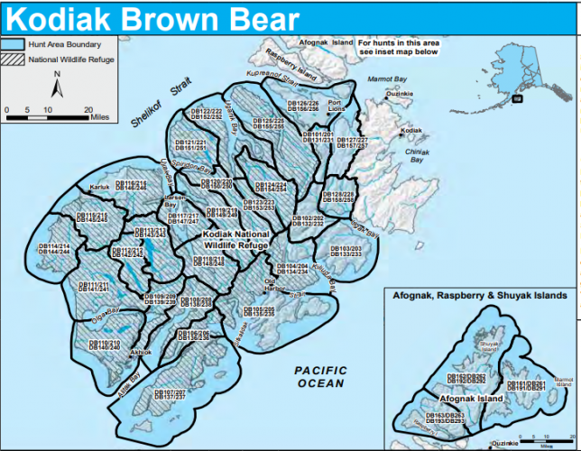
For instance there are a lot of Kodiak units, seems reasonable for someone to ask for a digital format of these boundaries.

The issue here is that Alaska like most other states has a Public Records act and it's agencies are compelled to provide this kind of information.

1646232792187.png
 
Last edited:
You’d mentioned it before, but try to use the Alaska Public Records Act to request. It’ll probably take forever, but at least they’d (likely) have to state a legit reason if they deny.

It’s speculation, but I’m guessing there’s a provision in that act to prevent information being used for profit, hence why OnX et al hasn’t already done this and incorporated the data you seek.
I filed an open records request with the department and stated explicitly that it's not for commercial use nor that I considered it a legally binding boundary. I also requested their legal justification for a denial which I'm entitled by law.

It's not hard for me to digitize the boundary, but this is public information, requested by a private individual for stated non-commercial use, it's a principle thing for me entirely at this point.
 
Has anyone ever encountered this in another state, not willing to give you the boundary of the unit you’re hunting?
WA was like this for a long time and sorta still is. They have no shooting zones in there wildlife areas that aren't on mapping, and when I asked about it, they just said, "they're well marked in the field". That's great, but what if I wanted to digitally scout? They also have these large reserve areas, where you're not allowed to hunt. Until just recently the only mapping was an old slideshow from a commission meeting.
 

Forum statistics

Threads
110,816
Messages
1,935,405
Members
34,888
Latest member
Jack the bear
Back
Top