On X Map Dates?

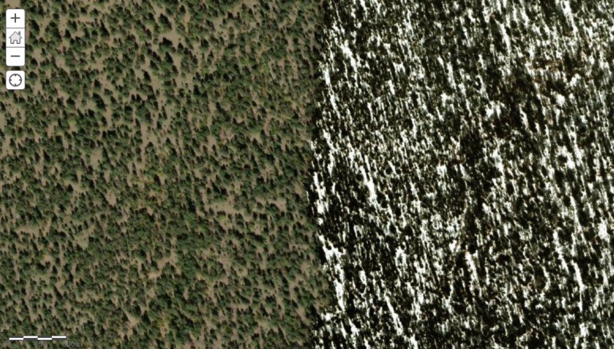
For a second I thought about asking “how many f&/@!ing satellites are there taking pictures?”. Seems Mapbox uses a variety of both commercial and public images. I remain convinced the date is attached to the file, so the puzzle is unsolved.

View attachment 275996
;)
 
;)
I hate you.;)
I just want the date of the $%&!ing picture. You would think I'm asking for nuclear codes.
 

I'm not sure how hard or easy it is for some to allow the app to expose imagery metadata, the link above should be helpful though.
Google Earth has dates. I just can't drop all the waypoints with little characters like blue squirrel or purple raccoon that make up my system. There a system, damn it!

Clearly no one at that company was thinking about hunting water tanks in the Southwest US when selecting the pictures.

Screenshot 2023-05-15 at 2.33.14 PM.png
 
Google Earth has dates. I just can't drop all the waypoints with little characters like blue squirrel or purple raccoon that make up my system. There a system, damn it!

Clearly no one at that company was thinking about hunting water tanks in the Southwest US when selecting the pictures.

View attachment 276008
I've been working around this by using Google Earth and OnX side by side. Locating in Google Earth, then type or copy and paste the coordinates into the OnX location search bar. Search. Add purple raccoon waypoint. Done
 
I've been working around this by using Google Earth and OnX side by side. Locating in Google Earth, then type or copy and paste the coordinates into the OnX location search bar. Search. Add purple raccoon waypoint. Done
I think we figured out that OnX and Google Earth might not be the using the same pictures. Little did I know that there seems to be incredible competition in launching satellites that take picture of the Earth and it’s not just NOAA or NASA stock stuff. I need some of those DOD and CIA photos. I can probably count points on the elk in those.
 
I think we figured out that OnX and Google Earth might not be the using the same pictures. Little did I know that there seems to be incredible competition in launching satellites that take picture of the Earth and it’s not just NOAA or NASA stock stuff. I need some of those DOD and CIA photos. I can probably count points on the elk in those.
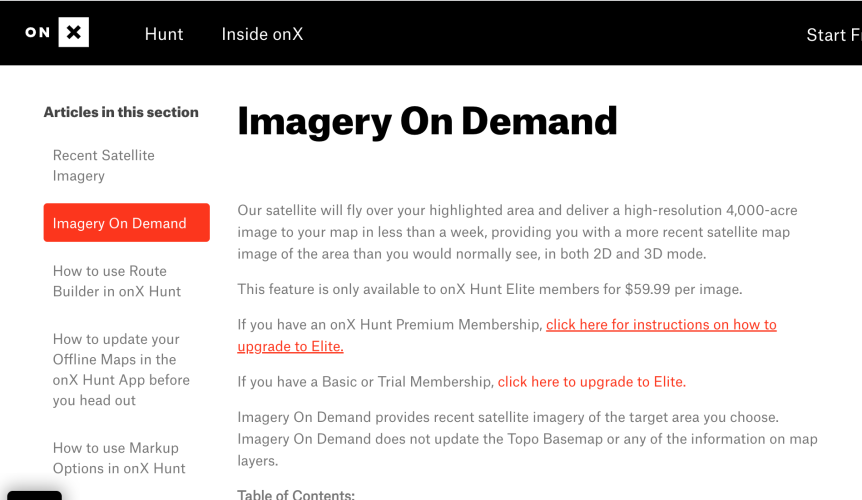
They're already offering "Imagery On Demand"! How long before we get an OnX Hunt satellite imagery livestream? I'd like to have the elk spotted from my couch before I arrive

Edit: At least they used to, I don't see the little satellite icon on my OnX at the moment.
 
Last edited:
They're already offering "Imagery On Demand"! How long before we get an OnX Hunt satellite imagery livestream? I'd like to have the elk spotted from my couch before I arrive

Edit: At least they used to, I don't see the little satellite icon on my OnX at the moment.
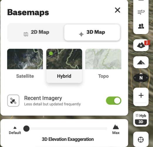
Looks like this is what you were talking about. See screenshot. In the terrain button that switches from 2D to 3D it has a button for Recent Imagery. It is correct in that it is less detailed, so it may not work for everything.

Screenshot 2023-05-19 at 2.01.42 PM.png
 
I was referring to this:
View attachment 276546Maybe @onX Hunt will chime in
As some folks have noticed here, we have recently come out with a couple of new imagery options. Imagery on Demand, which is currently being released allows onX users to order a custom, high resolution image for a particular area. This is an image that only the user that ordered it has access to and it can be ordered at any time. Our other imagery option is available to all Elite users and updates every two weeks with an image that is lower resolution. That imagery does have a date range for when it was taken so that users can get a good idea of things like snow levels, green up, leaf drop, etc.
 
As some folks have noticed here, we have recently come out with a couple of new imagery options. Imagery on Demand, which is currently being released allows onX users to order a custom, high resolution image for a particular area. This is an image that only the user that ordered it has access to and it can be ordered at any time. Our other imagery option is available to all Elite users and updates every two weeks with an image that is lower resolution. That imagery does have a date range for when it was taken so that users can get a good idea of things like snow levels, green up, leaf drop, etc.

Good info, thank you. I am on Android and not seeing the recent imagery option. Is that for iOS and Android?
 
Ollin Magnetic Digiscoping Systems

Latest posts

Forum statistics

Threads
111,114
Messages
1,947,537
Members
35,033
Latest member
Leejones
Back
Top