Day 5
Each new day is a decision whether to stay in the field or head home. I figure I can sit at home and feel sorry for myself, or else grind it out. The latter I have to believe is better for my health, so I stay. The night before I had a long night hike back to the tent so I slept in, having no game plan for an AM hunt.
My knowledge of mule deer behavior is quite limited, and I am trying to decide on where to look for older bucks. Before the hunt I mapped out main areas 1-3 within the unit. Area 1 was quickly eliminated as it was difficult to access, but easy to glass from the road, and other hunters would likely have noticed a buck in that small spot before now.
I had hunted the first finger ridge of area 2 the day before, and I now guessed older bucks would be staging a little higher in elevation, which was inaccessible private ground. There was some slightly higher elevation terrain in another direction, but I was hesitant to check it out. While it was hard to abandon area 2 knowing there was much more to explore, I took a gamble and left for the last and largest spot I had pre-scouted.
Area 3 is a pack-in hunt, 4 miles down a ridge, then drop 2 miles down a steep face into a huge valley miles long and miles across. I had sub-spots A-E to hunt in the valley. I reorganized my gear for a 4-day pack-in including all the water I'd need, as there is none to be found in the valley on account of the highly-porous sediment. My daypack was comically-overloaded with all my gear and provisions, but I managed to strap everything on it somehow.
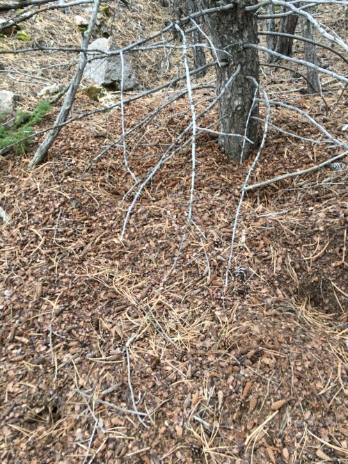
I set off hiking at 12:30 PM. I know pine squirrel middens are common, but I am always impressed by them. This one was 5 ft tall at the base of the tree, and tapered another 20 ft down a cut.
Near the bottom of the steep face it dawned on me that I forgot my cell phone battery pack. This ended up dramatically altering my hunt for the next several days as I would be without OnX, and I brought no back-up map. Also unfortunately, no camera. I figured I could at least get a couple days by conserving my current charge on the phone. Checking the level I was down to 8% Oh no! I must have let the device get too cold and/or left the screen on in my pocket for a couple hours. I quickly texted my wife letting her know I would give updates via InReach, and also assured her I could navigate my way out again.
Battery was now at 5% and failing fast. I made a very quick study of all my waypoints, private property boundaries, and made note of major landmarks. It was severely imperfect - I figured it would be better than hiking another 10 miles that day just to retrieve the battery pack. In retrospect, I should have just bit the bullet and made the hike.
I set up camp halfway down a canyon and out of the wind, then spent the evening glassing from sub-spot E. Fog and low clouds rolled in, reducing visibility to about 300 yards, and I saw nothing.