What are the chances a protest by an interested party would change the course?
"You miss 100% of the shots you don't take." - Oak
"Based on the analysis in the EIS, it is my decision that domestic sheep grazing will be allowed to continue as described in Alternative C.
Alternative C avoids overlap of pastures authorized for domestic sheep with core Rocky Mountain bighorn sheep herd home summer range, which ensures temporal and spatial separation while still allowing grazing. My decision also includes new permit terms and conditions to further reduce the risk of contact. This gives me a high degree of confidence that there will be low to no risk of contact with wild sheep that would result in disease transmission within these allotments." - Elizabeth A. Dawson, Acting District Manager (emphasis mine)
On the high elevation allotments being considered for renewal, the BLM has essentially made the decision to not allow domestic sheep to graze on the portions of the allotments that are mapped by CPW as bighorn sheep summer range, with no buffer. So draw a line in the dirt and bighorns can be on one side and domestics on the other side.
CPW defines summer range as: "That part of the overall range where
90% of the individuals are located between spring green-up and the first heavy snowfall. Summer range is not necessarily exclusive of winter range; in some areas winter range and summer range may overlap."
You can see what this looks like on paper on the map I threw together. The allotments being renewed in this area are American Flats, American Lake, and Henson Creek (typo in the shapefile).
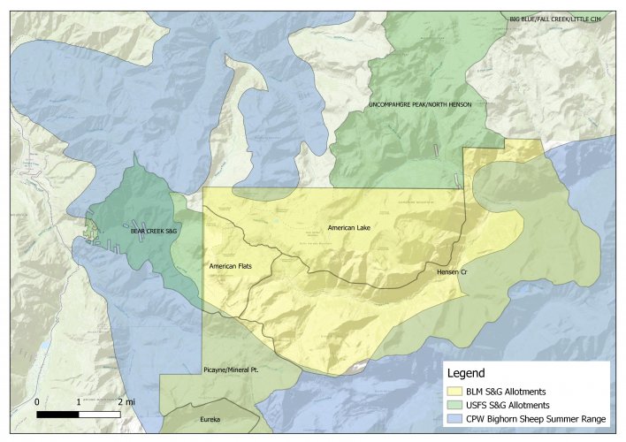
One question that comes to mind when I look at that map is, where are the other 10% of bighorn sheep during the summer grazing season? Another question that comes to mind is, do the bighorns know where these lines in the dirt are located?
Completely coincidentally, I was sitting on the boundary of American Flats and American Lake last Friday when the proposed decisions came out. This photo is looking east into the American Lake allotment from the A. Flats boundary.
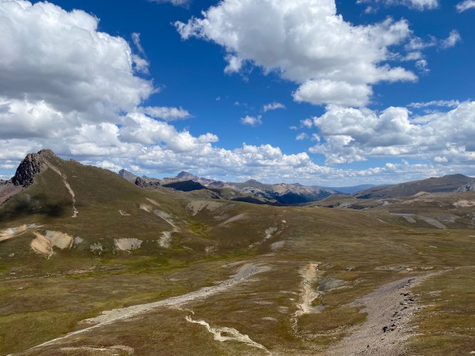
It was only about a 2.5 mile hike to this point after after an hour drive from the pavement. It's pretty remote and there is no cell service. If we go back to ADM Dawson's statement above, she notes additional T&C to reduce the risk of contact. Those include:
- "The permittee/lessee will immediately notify the local BLM authorized officer...of any observed or reported contact, or close proximity, between wild sheep and the permittee's/lessee's domestic sheep or goats."
- "The permittee/lessee will immediately report (as soon as feasible) to the authorized office (i.e., Field Manager) any wild sheep sightings in proximity to authorized domestic sheep or goat allotments or trailing routes."
So the BLM is relying on this guy...
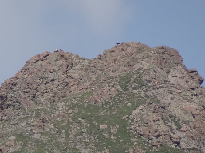
...to immediately notify the BLM if a bighorn wanders into his band of sheep below. How?
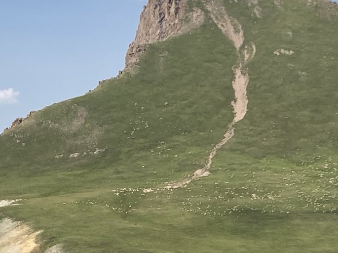
This is just a couple of many layers of bull$hit in this decision.
Oh, by the way, the CPW summer range polygon has changed since they did their analysis 3 years ago. The polygon on the map above is larger than back then. Why? Because CPW updates them regularly....