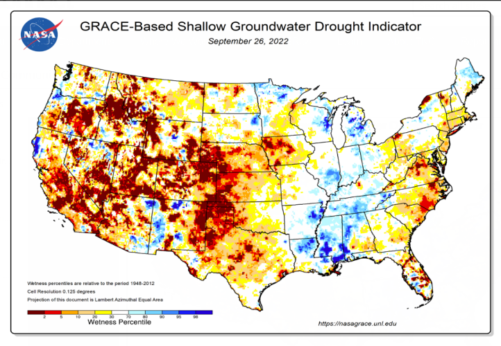
So I kinda hate big picture science because it inherently "lies", painting a picture that simply isn't true for specific locations. In the end I think it undermines science when people can quickly and accurate point to out errors/misconceptions/misrepresentations (whatever you want to call them).
View attachment 262482
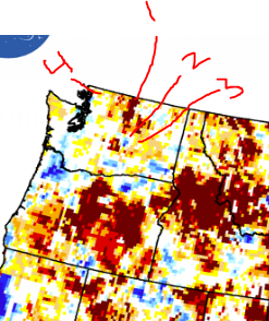
1. Groundwater resources has increased by orders of magnitude as the vast majority of that area is now recharged by controlled surface water impoundments long the Columbia and Okanagan Rivers.
2. The Quincy Area has experience >200ft of groundwater increases since the 1950s, when the "Project" started.
3. While the Odessa area, less than 50 miles east of Quincy has experienced >125ft of groundwater declines (not in the project).
4. Completely don't understand how this area is described. The aquifer completely recovers, to the ground surface in many locations much to the chagrin of residents, every single year.





 www.bbc.com