Is there any way you could share what your worksheet looks like. I do expedition planning as well that I would do for backpacking. It works great for the safey side of things and having the plan left with a loved one to hand off to S&R if that ever happens. I would love to see how hunting data could be compiled in a similar manner, seems like thats what you are doing.
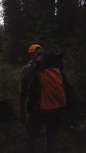
Here is one from an actuall hunt I did (specific locations changed).
Bear Hunt Operational Parameters
Objective
Kill a mature bear (preferably a boar) in the Predator Alley area and retrieve the meat/hide. This trip has a low probability of achieving that goal. The secondary goal is getting intel on a bears location.
Intel
Thus far, not much to go on. The High Roads do not appear to have a lot of sign in them. But could be checked out again at a slower pace or in different locations to confirm. Predator Alley has no current sign that I can see, but as of one month ago had a bear that seems to roll through to “adjust” my cameras around 0900 +-1hr. This might be the best thing to go off of. I think the bears are eating fawns right now. The berries are about a week or 2 from being ready at this elevation. Things are still quite hot so I imagine shade and water are the top priorities at the moment.
Hunt Plan
Until further intel can be acquired, Predator Alley is the most recent intel source I have to work with. As such the plan is as follows. Leave with Jillian at 0500 in order to get there by 0530. We will wait until twilight allows us to see comfortably. At this time we will proceed up the ridgeline above Predator Alley very slowly. We are looking for sign, and overwatch to predator alley. When a decent overwatch position is found, we will post up and watch the trail quietly (might want to be prepared for calling if that is an option) for activity through 1000. At this point we will return to the vehicle and attempt small scouting trips into water rich areas on the way home (starting with taking a look at the creek below the parking area to see if there is any water. If Predator Alley is occupied at arrival, trip will turn into a scout around Dutchman.
Weather outlook & Sunrise/Sunset Info
Sunny, with a high near 92. Not much variation from that. This is a “cool” day compared to recent weather.
Sunrise is at 0608.
Operational Limitations.
Range loading and hit points have been confirmed to allow for a good understanding of the bullet path. Chrono numbers have been logged and dope sheet created. Range Cap at this point with the weapon is 300 yards with current loading. Accuracy cannot be assured within acceptable limits beyond that.
Jillian is backup, and she is uncomfortable with any nighttime scenario. Also not up to date on lethal control, but is trained with bear spray. Lethal control falls to me.
Pre-Hunt Logistics
Pre-chill Cooler. Clean cooler.
Clean water bladder.
Get a few trashbags in the pack.
Set up hunting pack with full kit night of.
Check fuel in truck.
Meal Plan. Granola, epic bars, brownies and lots of water.
Check Weather Forecast
Coordinate time, and gear with partner.
Gear List
- ON me
- Rifle & Ammo
- First Aid kit with water purifier
- Water (2-3 liters depending on heat)
- Bino’s, Rangefinder, Tripod
- Mouthblown deer call, and moutblown turkey call.
- License & Tags
- 2lbs of snacks
- 3 game bags
- Skinning knife & Sharpening Stone
- Headlamp
- Multitool
- Jacket, Gloves
- Orange Paracord
- Lens Wipe
- Shooting bag
- Trekking poles
- Tarp
- Toiletries
- Orange bandana
- Compass and mirror
- In Truck
- Cooler with ice
- Climbing Gear
- Electronic Call Setup
- Chainsaw
Recap
Fawns and does found on the slope north of predator alley with some bear skat (a few weeks old) found on the westernmost part of that ridge. Manzanita are ripeish and that seems to be what bears are eating. Wind is swirly garbage for the morning part of the hunt, so might require longer shot to be feasible if a shooting lane can even be found. Blackberries appear to be a week or at most two, from being ripe. No response noted to calling (except a pissed off doe). Ridge north of predator alley is a HARD push to get to the saddle, did not manage to get there due to vegetation barriers and time. There is a road on the north side of that slope and the northern side of the slope is more passable (less vegetation), but I think that an “easier” way of getting to the saddle location would be to use predator alley to haul ass directly south of the saddle location and hike straight up to it.
The entry side (west) with the logging road to the first meadow is devoid of sign save for some cub scat. I am writing that off till the berries are really ripe.