Yeti GOBOX Collection

Antelope research

Outdooraddict

Active member
Joined
May 9, 2009
Messages
461
Location
Western CO
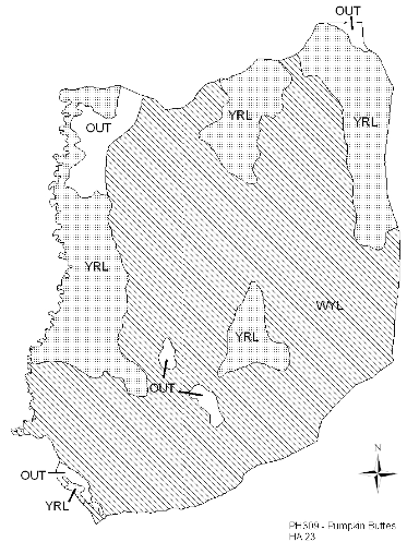
O.k. boys. Doing a little research for the next year's antelope season and came across this map and more like it. Maybe I missed something, but what does each abbreviation mean??

I see: CruWYL, YRL, SSF, WYL, and OUT :confused:

Any ideas of what they mean or where I can find out? Thanks!
 

Attachments

  • Screen shot 2011-11-07 at 11.16.52 AM.png
    Screen shot 2011-11-07 at 11.16.52 AM.png
    73.9 KB · Views: 536
I've never seen a map like that. What kind of research would you be doing that presents itself as that sort of map? I'm curious.
 
Eli, you pronghorn stud- this map came from the job completion report from different areas across Wyoming. Report includes all kinds of things including population, male/fawn/female ratios etc...

I was assuming it would be similar to Colorado's maps which show animal concentrations, migration routes, summer/fall/winter habitat, etc... I simply don't know, or can't find, what they mean.

Maybe, I should just ask you some questions- I think I'm wasting my time with some of this... But, I bet Fin knows.
 
Plugged those abbreviations into google and here's what I come up with.

CRUWIN = Crucial Winter Range.
CRUWYL = Crucial Winter/Yearlong Range.
WIN = Winter
WYL = Winter/Yearlong
SWR = Severe Winter Relief
SSF = Spring-Summer-Fall
OUT = Outside area
 
Npaden- you are the man. So, what did you come up with YRL- Yearlong range _? I still am trying to figure out the OUT- even if it is Outside Area... If you look at the map above, I know there are antelope there- so what's with the OUT? I'm assuming that the area was not surveyed for the statistics :confused: I'll get it figured out.

Thanks!
 
Yeah, I didn't notice it was missing the YRL, but I would bet on that = Yearlong range.

Are the spots marked OUT in an town or some other type of spot where they would have not categorized the habitat for some reason? Private?
 
Here's their definitions for the ones I posted.

Crucial ranges are defined as those habitat components which are the determining factor in a population's ability to maintain and reproduce itself at a certain level over the long-term.

Winter range is defined as a population or portion of a population of animals that use suitable habitat sites within this range annually, in substantial numbers only during the winter period from December 1 - April 30.

Winter/Yearlong range is defined as a portion of a population of animals that make general use of suitable habitat sites within this range on an annual basis, but during the winter months (commonly between Dec. 1 and April 30), there is a significant influx of animals from other seasonal ranges.

Spring-Summer-Fall range is defined as a population or portion of a population of animals that use available habitat sites within this range from the end of the previous winter to the onset of persistent winter conditions (variable but usually between May 1 and November 30).

Severe Winter Relief is defined as a documented range which may or may not be defined as a crucial range as defined above. It is used to a great extent only in occasional extreme winters.

Outside area is defined as areas which do not contain enough animals to be important habitat or are of limited importance to a species.
 
No, they are mixed between private and public- and they do have access. In fact, where the out is in the top left section of the map contains a walk-in area that is open for antelope.
 
No, they are mixed between private and public- and they do have access. In fact, where the out is in the top left section of the map contains a walk-in area that is open for antelope.

Ironically, that large "OUT" is almost all BLM land and accessible. The two smaller "OUTS" in the lower central are the Pumpkin Buttes and since there's little chance of water up there, there's little chance of animals. I hunted that area last year and while they weren't exactly tripping over each other, there were a good number of animals; just not much public land.
 
Tarheel, thanks for giving away my super-secret spot :mad:... Just kidding ;). This was just one map of the possible left-over areas for antelope. Anyway, how did it go and how far north did you travel? I figure it might be better up that way... but a long walk.

Either way, I'm clueless. Just need to get in some area and learn.
 
To add to your research, you can print the map page to a pdf then add that pdf image to your Google Earth installation. You will need to add all the unit boundaries included in the map but once done you can add the pdf and scale it to properly fit the underlying boundary.
The overlay, coupled with streaming Topo and BLM overlays should give you a decent idea of what the area is like.
 
WHOA!!! :confused:. Can I get overlayed more than once? :hump:

So, when I add it to google earth, it will become transparent? I see how it would work with google, Tell me a little more about the topo and ownership maps. I'll give it a shot tonight- might need a tutorial. Thanks for the info!
 

Attachments

  • Screen shot 2011-11-08 at 2.22.20 PM.png
    Screen shot 2011-11-08 at 2.22.20 PM.png
    221.6 KB · Views: 386
Tarheel, thanks for giving away my super-secret spot :mad:... Just kidding ;). This was just one map of the possible left-over areas for antelope. Anyway, how did it go and how far north did you travel? I figure it might be better up that way... but a long walk.

Either way, I'm clueless. Just need to get in some area and learn.

Sorry, didn't think I was giving away too much. Last year the WF&G let more tags in that area than any other in the state, and draw odds were good due to the relatively small amount of public area. The walk-in area is a combined 3 sections and has to be accessed from the North off I-90, but it abuts about 40 sections of BLM and state land which is accessible by numbered and named roads, so there should be plenty of opportunity. I don't know when the survey was conducted, but I see little reason why you couldn't find plenty of opportunity. My time was very limited, and I'm ashamed to say that my nephew and I opted to hunt ranch land and pay a modest kill fee because there were just too many unknowns and we had both traveled too far to wind up chasing a few animals around the pumpkin patch. I had hunted antelope in CO and Wy many times in the past and just wanted him to get a taste of what it was like since all he had ever experienced was whitetail hunting in NC and the piney woods of Texas. After dressing out two gut shot goats I think it might be a while before he gets that smell out of his nose, but I don't think it will keep him away for long. He's lathering to get a nice mulie, so I anticipate another trip west before long. We held six tags but only filled four of them, all on the same day, not from lack of animals, but lack of time and cooler space. We could have fitted more in, but we both wanted to keep our heads and capes & those took up too much room.

Leave some for seed!
 
WHOA!!! :confused:. Can I get overlayed more than once? :hump:

So, when I add it to google earth, it will become transparent? I see how it would work with google, Tell me a little more about the topo and ownership maps. I'll give it a shot tonight- might need a tutorial. Thanks for the info!

The Vimeo link:
http://vimeo.com/user3024489/videos
Tutorials for adding Topos to Google Earth and ArcGis Explorer

here is the BLM SMA link:
http://www.geocommunicator.gov/ArcGIS/rest/services/SMA/MapServer/kml/mapImage.kmz

Both are server links so it will fill in as you move in/out. Also, they are not GE native so they can get a little finicky. Sometimes you need to zoom way out to get the Topo to fill in.
 
Last edited:
Ollin Magnetic Digiscoping Systems

Forum statistics

Threads
111,145
Messages
1,948,659
Members
35,048
Latest member
Elkslayer38
Back
Top