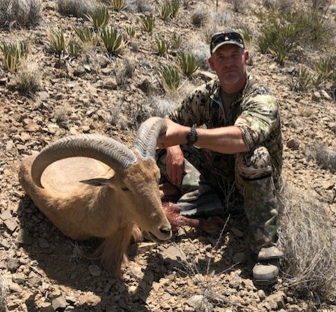
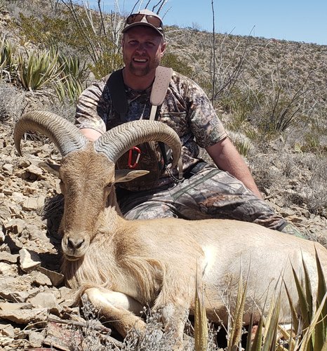
Barbary Sheep NM

I shot an old ewe in West Texas 20 years ago. I had never heard anything either way about eating them, so I blindly treated it like any other venison. I remember it being lighter colored, no gamey/musky smell, and being tough as boot leather. Even the backstraps were. I would plan to braise until it falls apart or grinding for sausage. I think it would be fine with those techniques. Worst case, mix it 50-50 with pork shoulder and make a hot Cajun style smoked sausage.
 
Make sure you know where you are as the southern end of the unit west of Timberon is actually part of the draw unit..onx doesn’t show that
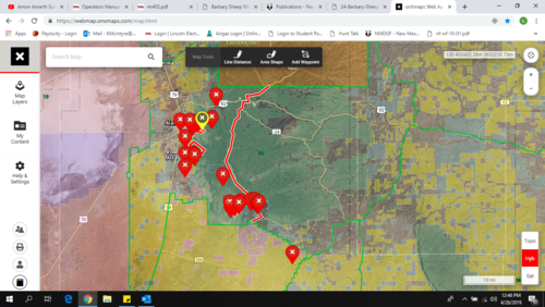
According to the description in the New Mexico rule book description of unit 34 west: "...continuing south as it transitions to County Road E12 (Sacramento River Road). County Road E 12 south to the Unit 34/GMU 28 boundary". That road heads out of Timberon toward the unit boundary. My understanding is everything west of that is open for OTC. ONX only shows unit 34 as a whole, I went in and plotted the boundary according to the description. I wouldn't intentionally violate those rules and if you have any more clarifying information I would be happy to take a look at it.

The red line is what I have plotted as the boundary:105157
 
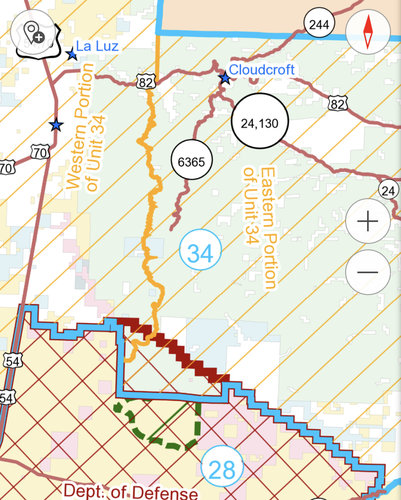
If you can’t hunt anything below the carry map red line or east of the yellow how do you figure? All of his southern most pins are in non otc area
I believe the boundary the OP is talking about is the north/south red line on his map which matches exactly with what is described in the 2019-2020 Hunting regulations booklet.
 
Not quite. Via the game and fish carrymap app
I'm not sure how you can get anything out of a map that vague. There is nothing on the map to reference how any of those lines are plotted. Also what is the red line running east west on that map? It isn't referenced at all in the rule book. The southern boundary as described is the unit 28 boundary.
 
I'm not sure how you can get anything out of a map that vague. There is nothing on the map to reference how any of those lines are plotted. Also what is the red line running east west on that map? It isn't referenced at all in the rule book. The southern boundary as described is the unit 28 boundary.
Because it was zoomed out. When zooming in the app it shows below the red line needing the fort bliss pass...not saying it’s right or wrong either way but that’s the app game and fish says to go off of.
 
Because it was zoomed out. When zooming in the app it shows below the red line needing the fort bliss pass...not saying it’s right or wrong either way but that’s the app game and fish says to go off of.
I'm going to have to dig into that, if they have maps we are supposed to use they aren't exactly up front about it. That map conflicts with what is printed in the rule book. I want to say I appreciate you pointing this out. I'm not sold on your interpretation entirely but I'm not disregarding it.
 
I've drawn a tag for theDecember hunt. Have never been in that area, nor have I ever seen a Barbary sheep. Four gmu's hunt area indicate to me that you can never even begin to check it out properly in just two weeks, scouting every day. Where do you start, not knowing the area, the species, and deal with the land trespass issues, when things are not clearly marked? A Barbary hunter last Fall got fined $5,000.00 for trespassing.
The best of luck to you on your hunt!
 
So I spent some time this morning re-reading the 2019/2020 rule book. I cannot find any reference to the souther border of the otc area in unit 34 being anything other than the unit 28 boundary as listed in the description. What i did find was this:

GMU 34: Grapevine Canyon (McGregor Range Buffer Zone): Subject to closure by the Forest Service and/or the military during missile firings. This area in GMU 34 is accessible with military permission only. For access information contact the Fort Bliss Security Office: (915) 568-3215.

As you can see this doesn't do anything to delineate what this area is geographically. I do plan to talk to Ft Bliss and see what they have to say, further language in the next section implied that the area was only closed during missile testing and roadblocks would be in place.

I did also find the link to the maps you are using, and if the state of New Mexico wants those to be the maps we reference they are going to have to do a better job of advertising and making them available. I had to go digging into the book to find the link. I haven't had a look at the maps yet as I am not going to download a program to my work computer to do so.
 
Hunted dear in the lower part of 34 years ago. I remember signs showing entrance to MacGregor range. I would not cross that border. Have always heard there were lot of barbary on the northern end of MacGregor, but on two oryx hunt, I have not seen any.

I think most of the barbary are located north of Alamogordo and south of High Rolls. Saw a picture of a monster taken from there. Still rough country and wish you the best.
 
Well I made some initial calls, and no one at the number listed seems to know anything about this at all. They passed me on to range control who seemed equally confused because I was not asking about accessing any training areas. I sent an email to the email address listed in the rule book for GMU28 Ft Bliss access and it returned undelivered/invalid email. I can see how folks might lose their mind trying to sort this stuff out.
 
I’m not sure about the range issue but the carrymap app corresponds to the boundary in the 2018 -2019 rules book. Your map looks correct by the new rules book.
 
Well the range issue has me thinking I need to push this weekends plans a little further north until I can sort it out. I am a little irritated that the rule book states you have to have Ft Bliss permission to enter an undefined area. Especially when no one at Bliss seems to know anything about it. I plan to give NMDGF a call at lunch but I don't have a lot of hope for clarification.
 
Well I spoke with NMDGF yesterday. The gentleman got back to me after I left a message on Tuesday. The range issue has to do with the road coming up to the grapevine canyon crosses a training area. He gave me a name to try and get a hold of on Bliss for clarification but did not have a contact number. He also said he didn't think there was access from up above in the Timberon area. The forest service never responded to the message I left them. I am going to push a little north out of that area this weekend but I will keep looking into it.
 
Well I spent the last two weekends at home, my back went into a full on revolt and I needed to rest it. I did get a hold of a guy I knew that used to be the game warden on Ft Bliss. He made some calls for me. I never did get a real description of what is considered Grapevine Canyon. From the Ft Bliss perspective they call it 506 North and do want hunters checking in and out with range control. They also expect you to get a pass and register your firearms with the post. I will be staying out of that area and move my hunt into the canyons north of there. Army doesn't own me any more so I won't be jumping through any of their hoops. I will be getting back after it on the 3 day at the end of the month, probably the following weekend as well.
 
Yeti GOBOX Collection

Latest posts

Forum statistics

Threads
111,112
Messages
1,947,530
Members
35,033
Latest member
Leejones
Back
Top