Yeti GOBOX Collection

University of Arizona - Anti Public Land Project

AvidIndoorsman

Well-known member
Joined
Dec 9, 2015
Messages
18,249
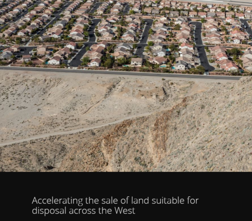
I came across this project in ArcUser, ESRI's GIS users magazine. I found this line particularly distressing, "Although the project did not include research on the market impact of disposing of 10.7 million acres within a few years, it provides enough evidence to open the door for those interested in real estate market to start looking at the impact on both a local and national scale."

This analysis is done to justify pro transfer with the directly stated goal of expanding cookie cutter development across the west.
107491


https://ourland.arizona.edu/index.html
 
It's a well made and slanted story map that's for sure.

At the end of the map is a hyperlink to an ArcGIS Online layer item of disposable lands. I encourage folks to click on it, change the basemap, and explore it.

http://www.arcgis.com/home/webmap/viewer.html?webmap=da0b20a3cca2430ea3ce626989a276fe

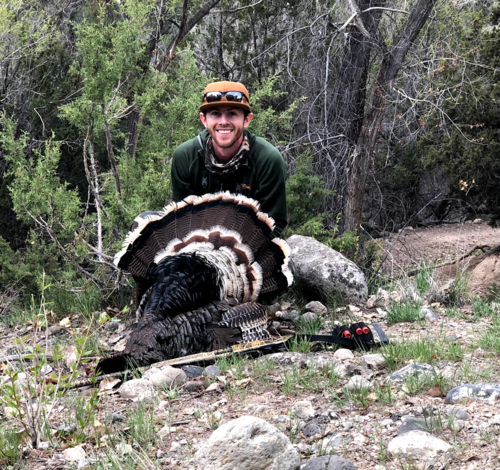
I won't say exactly where, but within those lands symbolized as disposable, which is an actual list of parcels created by the BLM, is a parcel that gives access to a local creek. On that parcel of BLM my daughter caught her first fish.

Here's a picture of that day on that chunk of land. Disposable my ass.
KayleesFish.jpg
 

Attachments

  • KayleesFish.jpg
    KayleesFish.jpg
    130.9 KB · Views: 0
It's a well made and slanted story map that's for sure.

At the end of the map is a hyperlink to an ArcGIS Online layer item of disposable lands. I encourage folks to click on it, change the basemap, and explore it.

http://www.arcgis.com/home/webmap/viewer.html?webmap=da0b20a3cca2430ea3ce626989a276fe

I won't say exactly where, but within those lands symbolized as disposable, which is an actual list of parcels created by the BLM, is a parcel that gives access to a local creek. On that parcel of BLM my daughter caught her first fish.

Here's a picture of that day on that chunk of land. Disposable my ass.
KayleesFish.jpg
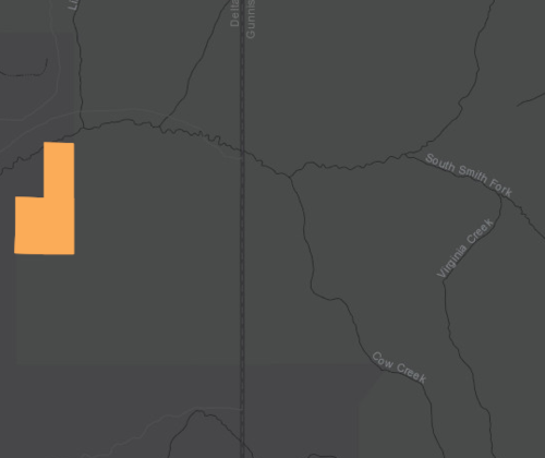
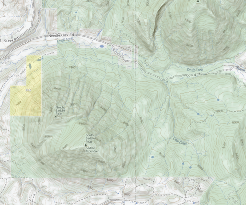
The orange parcels are the ones identified as disposable?
 
Yep. A few of the spots I hunted turkeys in this year are identified as disposable.
 
There’s a lot of good land near me, west of Maricopa AZ that is ‘disposable’
As well as some more south of Stanfield.
What nonsense.

With our lax trespass laws, I’d bet 100% of it is accessible. I’ve been on some of it.
 
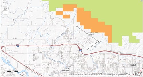
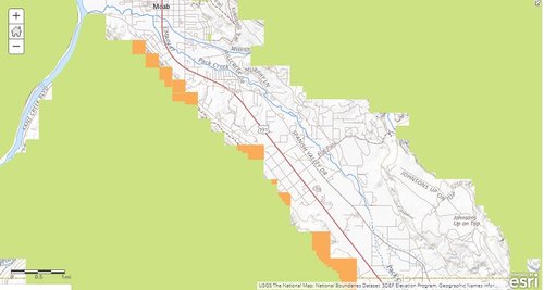
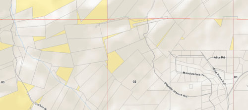
Without diving into the report to see how they developed the list of parcels, it appears to be based primarily on the potential for development rather than lack of access. Here are a couple of examples below I noted in 5 minutes of looking at the map. These parcels are contiguous with adjacent BLM lands.

Grand Junction.jpg

Moab.jpg
 
Without diving into the report to see how they developed the list of parcels, it appears to be based primarily on the potential for development rather than lack of access. Here are a couple of examples below I noted in 5 minutes of looking at the map. These parcels are contiguous with adjacent BLM lands.

Which is many ways is actually worse, the idea what we should just keep cities ever expanding and encroaching on habitat. A number of these disposable land fragments, create migration corridors, green zones, and pockets of habitat from everything from turkey's to elk. I think what people miss is that we actually don't want consolidated blocks of federal land, we want little pieces undeveloped lands all over the place. The checkerboard nature of many areas keeps those areas from being developed, regardless of whether I can hunt a spot I want habitat to exist. That is not to say that their probably aren't beneficial swaps and trades to be made, but this project was specifically started to identify 10.7 million acres of public lands in Arizona to sell to private developers in the next 4 years per HR 3333.

Here is the full text.
https://www.esri.com/about/newsroom/arcuser/fedlandreg/
 
Without diving into the report to see how they developed the list of parcels, it appears to be based primarily on the potential for development rather than lack of access.

I think this is largely true, though I think the designations under the BLM's Resource Use Designation and Determination plans were created in silos by different field offices, sometimes as much as 30 years ago. When Chaffetz had HR 621 out there I was very concerned about what was disposable and what wasn't, and the only place I could find the disposable lands list near me was looking through the Butte Field Office RMP, and I think it was over 20 years old at the time. It turns out none of the parcels in my neck of the woods were on the chopping block under Chaffetz bill, but I bet something similar comes around again. It sounds like the BLM has compiled those lists now, but I would bet that if they were forced to come up with a contemporary list it would look a lot different.

There are quite a few parcels out there that are in a way "disposable".Though I don't think accessibility should necessarily dictate the designation. I can think of a few parcels that are inaccessible, that still provide value as open space or habitat, and could be accessible under the right circumstances. There are those parcels though that it doesn't make sense to have in the public lands catalogue, and utilizing them in some sort of land banking program would be the best use IMO. This is my backyard. None of these parcels will ever be particularly useful to the public, and already exist in a chunked up (and more developed every day) piece of country. Selling these and using the money to buy parcels in a strategic manner that revolves around access, or other valuable chunks of land, could provide great benefit.

107523
 
With the immigration from South of the border, people have to go somewhere. With that, and a westward and southward movement in America, this situations will only increase.
 
Selling these and using the money to buy parcels in a strategic manner that revolves around access, or other valuable chunks of land, could provide great benefit.

100% agree especially when it comes to some of those slivers that are under 10 acres, unfortunately I think the drive isn't to sell these to fund purchase other acreage, ie stay acreage neutral. I think the goal of those that push these bills is to sell these lands, through the proceeds into the general fund of the department under the guise of funding the agency and then siphon it off for other projects. Due to this fact I'm extremely wary of any land deals, on a case by case basis I will definitely read the facts and make a comment for or against, but as far as sweeping legislation I would never support any bill that sought to sell/transfer or consolidate public lands.
 
Back
Top