Use Promo Code Randy for 20% off OutdoorClass

Hard To Reach Water E-Scouting

hammer3332

New member
Joined
Feb 7, 2020
Messages
3
Hey all,

I am from the Midwest and primarily hunt whitetails (shocker). I have been on one 6 day 3rd season rifle elk hunt in Colorado with a buddy and we were “early” or in lower elevations. Didn’t see an elk until the last day, and didn’t harvest anything. We are now planning an OTC archery hunt and have some areas picked out. It looks like where we will be hunting is pretty dry so far this year. Since I am unable to get boots on the ground, how do you e-scout for hard to reach water sources? Do you look at elevation gain and loss? Do you look at slope and distance? How far off of a trail is hard to reach? I have limited experience with topo maps in mountain country, so trying to get a barometer on sucky terrain vs easy terrain.

Thanks in advance!
 
In mountains look for Green fans from springs coming out of the mountainsides on Google Earth. Especially in the desert, Springs will be identified on BLM, USFS maps and ON-X.

Another source is North Slope snowbanks. Usually gone by Hunting season though.

An elk is going to need 5-8 gallons of water a day and will travel 3 miles to get it in open country. Usually after dark. They will hit little seeps in heavy cover at midday though.

If it is a reliable water source there will be well worn trails to it.
 
Our last trip to 86 was super dry. On fire in Salida even. But if you follow a marked creek you should find where it finally pops out. Where we were hunting we found surface water at like 8000ft an it was thick. But lots of sign from lots of critters. Some of the creeks out of high counrty lakes were even dry looking in spots. We started working anything shady near there with food. Saw lots of deer an even bounced a bull. Its tough being patient hunting water an not just go look an see whats in the next drainage. I get bored easy.
 
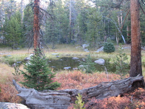
I look for "water loving" vegetation. You can sometimes find it when looking at the fall colors and differentiate different plants by their leaf color. Sometimes water can be found by digging a little even if there is nothing present at the surface.

We run into this issue in some areas we hunt here for various reasons, one being the available water is so silty it will plug a filter, even after decanted for a day or more, or its just plain dry.
 
In western Montana the water indicators are Alder or mtn. Maple. In central mt. To westerly its quaking aspen. In google earth its the lighter green patches among the conifers.

For the brave ones, most of the springs are associated with unit boundaries or fault zones using geologic maps west and north of Missoula. Water depends on the units. In the Bitterroot valley along the west side in the intrusive, springs are more controlled by faults. Beware most of the geologic maps at 1:100,000 fail to show the small faults that control many of the spring.

I can't help you much in the lands of not enough water. All my comtacts are in the lands of too much water.
 
Thanks for all the responses to this! We ended up hunting some cattle ponds that were unmarked on OnX and got in to fresh sign and managed to get a Bull to respond to bugling. Couldn’t seal the deal, but definitely looking forward to getting back!
 
Back
Top